Monday, October 30, 2006

Georeferenced products of the 1st & 2nd Military Survey of the Habsburg Empire completed

Image Courtesy of Arcanum Publisher. HUNAGI Visuals Resource, 2006
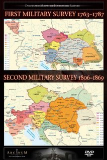
The digital processing of the First and Second Military Survey of the Habsburg Empire completed

The products have been released by the Arcanum Adatbázis Publisher in 2006. What you should know about these Surveys:

The First Military Survey of the Habsburg Empire was made 1763–1785. It contains almost 3400 colorful, hand made, 1:28.800 scale map sheets.
This DVD includes:
• the full territory, 968 map sheets.
• 23000 names of 9974 settlements with sophisticated search engine
• studies on military surveys.
Features of the presentation program:
• maps can be used in their original form (scanned image with information on the map frame) or as a mosaic version.
• very fast moving and zooming from the whole mosaic to 100%, distance function
These map collections are very useful for archeologists, family researchers, ecologists and other scientists as well as for amateurs.

The Second Military Survey of the Habsburg Empire was made 1806–1869. It contains almost 3500 colorful, hand made, 1:28.800 scale map sheets. Arcanum presents the georeferenced version of the map sheets with accuracy of 50–100 m. This DVD includes:
• the full territory, 1111 map sheets.
• 25000 names of 11044 settlements with sophisticated search engine
• studies on military surveys.
Features of the presentation program:
• maps can be used in their original form (scanned image with information on the map frame) or as a georeferenced mosaic version with WGS84 (or user defined) coordinates.
• very fast moving and zooming from the whole mosaic to 100%, distance function
• exporting to standard projection systems. Supported: JPEG2000, GeoTIFF, ECW.
These map collections are very useful for archeologists, family researchers, ecologists and other scientists as well as for amateurs.

The First and Second Military Survey of Habsburg Empire is one of the most important historical map of Central Europe. The whole system contains almost 7.000 high resolution map sheets (800-1000/DVD) with scale 28.800. The map sheets of second survey are georeferenced and the presentation program (GeoView) let you to handle efficiently this huge collection. We handle the first survey as a huge mosaic so you can use it as a big map (without georeferencing). We made a gazetteer containing about 100.000 names of almost 50.000 settlements (old and new and alternative names). The sophisticated search engine helps you to find your places on map.
For the better understanding the discs contain different studies: history and content of the military surveys, book from 1783, how to make maps, etc. The book inside contains detailed scientific information and method of the georeferencing the second survey. This revolutionary method let you to compare the old maps with the new one, with satellite picture, with elevation modell, etc.

GeoView program
About the software
Geoview is a special software for displaying huge image-collection, especially maps collections. with its georeferenced information. The mosaic can be viewed, zoomed, printed. There are parts of the program: AAView shows the original bitmap (not the mosaic), MAPView shows the map collection without georeference information.
Elements and functions of the interface
The viewer consists of three windows: in the left, bigger pane is the mosaic itself (adjusted to the pane at start); in the lower right pane an overview appear, showing where you are in the mosaic and helps to move on it. You can drag (pressing the left button), you can draw a rectangle by pressing right button (in the small and the big picture too) and you can see this territory. The status bar shows the current zoom in-out percentage, or when measuring distance we can read the measured distance at that place. In this line we can see the georeferenced information (WGS84 and original CASSINI coordinates). Click on it and you can change the coordinates system to your need.
Measuring the distance
You can measure distances in real units (for example meter or kilometer) on the map. Just press and hold down the CTRL key, then click on the second (third, fourth etc.) points. The right side of the status bar shows the distance data. Press the SHIFT key to delete the measure line.
Exporting images
If you press the key „E“ or the appropriate button, you can convert the visible part of the mosaic. You can choose your projection system and resolution you need. ECW, GeoTIFF or JPEG2000 format is supported.
Displaying the original picture
Sometimes you need the original picture itself, information outside the frame, e.g. settlement names, signature, etc. Just press key „T” and you can see (by AAView progam) the original bitmap image. You have some new features: you can rotate the map for better understanding or print the original map itself.
Gazetteer and studies databases
You have two databases on your discs. The studies database contains relavant articles on this field. You can read, print or search this database. Every database has hierarchical structure (book, chapter of studies, country, county, settlement of gazetteer). The whole gazetteers database contains almost 100.000 names of 50.000 settlements from the Habsburg Empire. We read the original maps, looking for a settlement, and if we found we checked the modern maps and historical gazetteers to find out the present name of the old settlement. The database consists:
Original territory is the first level of the hierarchical structure of names. One disc can contain one territory (e.g. Hungary) and other one more (e.g. Lombardie and Oberösterreich). The second level is the country today. It can be many countries (e.g. in the case of Hungary: Slovakia, Austria, Croatia, etc.). The third level is the present administrative unit, which is very different in different countries (e.g. Burgenland, Oberösterreich, etc. in Austria, Belluno, Bergamo, etc. in Italy). We have one exception: we use old counties (from 1913) in the case of Hungary. The last level is the settlement itself. You can see following field in records:
Settlement today: The present name of the settlement
Name on the map: In general it is the old name of the settlement (e.g Brünn for Brno, Lemberg for Lviv, Krakau for Kraków), sometimes it is only a name (geographic name, terrain maybe hill). We use some symbols in this field:
= : the old and the new name is the same
– : There was no old settlement (it is was exist in that time)
? : Unreadable name
Country today: The present country of the settlement.
You can search the database according to every word, old and new name, countries and administrative units two or combination of it. Don’t be afraid from the special letters, we have hidden text without accent and special characters so you can search with or without special characters. (e.g. c instead of è , o instead of o, l instead of ³). Important: check always the word list on the right side as you type the name the program jump to it and choose your selection from list. When you find your searched settlement in our database, you can click on it and the program jump to the coordinates of this place.
Important: We have old name from the second survey and we use this names for the first one. Sometimes the name on the first map can be different from the second one. But you can use the present names, it is the same for both survey.

András Gilyén won the Prize of Originality of the European Patent Office

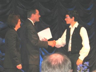
Ceremony at the 18th European Union Contest for Young Scientist in Stockholm, where András Gilyén won the European Patent Office’s “Prize for Originality” . Image Courtesy by A.Gilyén, HUNAGI Visulas Resource, 2006
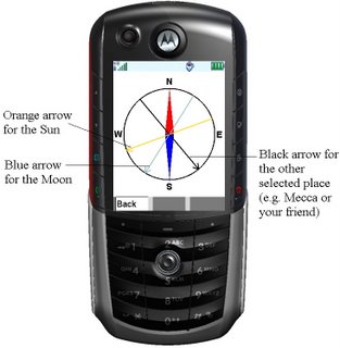
Directional Compass implemented on mobile phone won the First Prize on the National Scientific and Innovation Contest for Youth of the Hungarian Society for Innovation

The award winner is András Gilyén, Student of St. Margaret Grammar School, Budapest, Hungary (Class 12). He introduces himself for the HUNAGI community:
"I was born in Budapest, on 2nd July, 1988.
I attended the Elementary School (Class 1-6) between years 1995 and 2000 at “Don Bosco Catholic School, Budapest. I have been admitted in 2000 to St. Margaret Grammar School, at present I attend class 12.
I had permanent interest about subjects of science, what became more intense within the years in grammar school. I participated here on contests on mathematics and physics in every year. Two years ago I won First Prize in National “Arany Dániel Mathematical Competition”. Last year I could be classified to get into third (final) round of National Competition for Grammar Schools in Physics – where I won 25th position (among all grammar school students in Hungary).
I am founder-member of “Indukció Scientific Student Circle”(http://itdk.uw.hu ) of my School, at present I am its Student-Chairman. Today this student circle is among the best 3 grammar school’s student circle in Hungary. In all of past three years I held lections on the “St. Margaret School Days” about the following topics: “Simple Engines and Pulleys”, “The Perfect Numbers” and ”The Beauty and the Mathematics”. In 2005 I won 2nd Prize in my school with my “Arch-Suspension Bridge made by Maccaroni” on the “Contest for Demonstration Devices for Physics”. In June 2006 I won first prize on the 15th National Scientific and Innovation Contest for Youth organised by the Hungarian Association for Innovation.

My project was “A directional Compass implemented on a mobile phone”. This prize gave me the possibility to participate on the 18th European Union Contest for Young Scientist Stockholm, Sweden, where I won the European Patent Office’s “Prize for Originality” in September
"

As it was announced at the 15th National Conference on GIS in Education held in Budapest last week, by invitation, András Gilyén is today the 47th Member of the Student Division of the Hungarian Association for Geo-information HUNAGI. Congratulation to him for his outstanding performance in the field of innovation!
Related sources: European Patent Office , Hungarian Association for Innovation

Thursday, October 26, 2006

UN SDI HUCO blogs opened!

Within some hours after first announcement experts from 22 countries
have visited the entry blog. Content: Digitalpoint Geovisitors, 2006 Screensnapshot: HUNAGI Visuals Resource, 2006

Interactive blog system of the United Nations Spatial Data Infrastructure Hungarian Coordination Office established on 25th October 2006.
The content of the blog system is as follows:
Home
News (Shared with HUNAGI)
Meetings
Forum
Programmes
Partners
Links
Background
GeoNetwork
Documents

Direct link to the Home: http://unsdihu.blogspot.com or simply click on the Title of this spot
There is a permanent link with the Home page on the left side under the chapter LINKS.

Tuesday, October 24, 2006

15th Annual Conference on GIS in Education

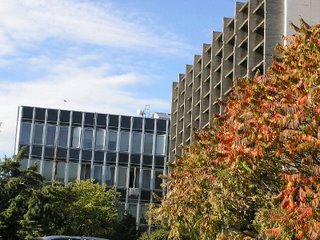
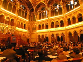
Venue of the Conference. Image: HUNAGI Visuals Resource, 2006
GIS and Capacity Building in Hungary
15th Annual Conference


Budapest, 25th october 2006

Programme: here
Annotated photo report: www.hunagi.hu Photo collection ... Events... 2006


Thursday, October 19, 2006

eContentplus 2006 project proposal with HUNAGI as partner

Project proposal called eSDI-Net+ with Hungarian participation

The full description of the proposal can be found here

Bentley Systems Hungary Ltd Open Day on geospatial infrastructure

Mr.Péter Rudolf, Director of Bentley Systems Hungary Ltd. welcomes the participants. Image: HUNAGI Visuals Resource, 2006


Topic "Geospatial infrastructure" attracted full house audience

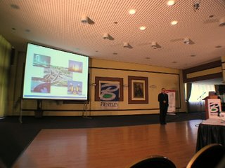
Mr.Camateros in action. Image: HUNAGI Visuals Resource, 2006

Keynote presentation was delivered by Mr. Styli Camateros, Vice President of Bentley Geospatial.

His talk covered the overview of driving elements, the products, applications and the overall recognition made by the Daratech comparative analysis, where in the AEC category Bentley is said as world leader on the market.

Participants of the meeting. Image: HUNAGI Visuals Resource, 2006


More photographs: www.hunagi.hu ... Photo Collection... Events... in 2006

Wednesday, October 18, 2006

HUNAGI has been invited to the Conference of the Civil Societies

The Upper House of the Hungarian Parliament hosted the Conference on " Modern Hungary: Everyday Democracy and Strong Civil Society. On the picture: Gábor Farkas, President of the 2006 award winner "Future of Europe Society". Image: HUNAGI Visual Resource, 2006

Conference of the Civil Societies hosted by the Upper House of the Hungarian Parliament
Budapest, October 18, 2006
The Conference was opened by Ms. Dr. Katalin Szili, President of the House of Representatives.

568 representatives of about 500 civil societies attended the Opening Session of the two days Civiliada 2006 organised by the Európa Ház, Budapest.


Mr. Pekka Kujasalo, Ambassador of Finland delivered a message from the Finnish EU Presidency point of view. In the background Ms. Edit Herczog, MEP. Image: HUNAGI Visuals Resource, 2006

The activities of the Finnish EU presidency were emphasized with the Conference in Lahti devoted to innovation and Energy Issues.
The Finnish Government has close links with the civil societies addressing the issue, how innovation can be transformed into products keeping in mind the Lisbon Strategy.
Mr. Farkas, representative of one of the most successful civil society articulated some criticism on the present Hungarian practice of the authorities having often unacceptable long throughput time of the administrative paperwork.

Tuesday, October 17, 2006

eContentplus Stakeholder Consultancy Meeting in Luxembourg


Text will come asap

Friday, October 13, 2006

World Food Day 2006 Event in Budapest

Ms.Maria Kadlecikova of FAO SEUR, Mr. Fülöp Benedek State Secretary of MoARD and Minister for Agriculture and Rural Development Mr. József Gráf Image: HUNAGI Visuals Resource, 2006

Invest in Agriculture for Food Security -
the whole world will profit
World Food Day 2006
16 October 2006

Acknowledgement of HUNAGI by FAO SEUR

After the written message of the President of the Hungarian Parliament Ms. Dr. Katalin Szili and the Opening Speach of József Gráf, Minister for Agriculture and Rural Development of the Republic of Hungary, the invited speakers of the event were talking on the following themes:
Prof. Csaba Csáki: Priorities in the World Agricultural Production
Prof. Pál Romány (initiator of the World Food Day in 1979): Programmed agriculture or traditional single production?
Dr. Péter Péter: Investments in food industry
Taking into account, 70 percent of the World's hungry live in rural areas , and of which 3% coming from the Central and Eastern European subregion, as well as the investments are vital for the economic growth, sustainable agricultural and rural developments, the three messages of the conference part of the event were as follow:
- the best investment is the train of trainers and education starting from the elementary school (emphasized by the Minister and Professor Romány),
- the investment in infrastructure helping connectivity eg. by roads (emphasized by Professor Csáki and Dr.Biacs) and
- using synergy of partnership between the government, NGOs, academia and private sector (emphasized by Ms. Maria Kadlecikova also in her dedicated morning report broadcasted by the Kossuth Rádió)

Invitation and the FAO World Food Day 2006 Medal. Image: HUNAGI Visuals Resource, 2006

After the Closing word of the host Ms. Maria Kadlecikova of FAO Subregional Centre for Eastern and Central Europe, she awarded Minister József Gráf with Osiris Prize, Mr. Fülöp Benedek State Secretary of MoARD with FAO's gold medal, Deputy Director General of the Department of Foreign and EU Affairs of MoARD with silver medal and - among others - the former FAO desk officer of the Department of Land Administration, MoARD and HUNAGI Secretary General with bronze medal. A HUNAGI leaflet in English was available for take-away describing the recent activities including the establishment of the UNSDI Hungarian Coordination Office. The leaflet is available at www.hunagi.hu About ... Leaflets ..asap.

Maria Kadlecikova of FAO SEUR and Mr. Rudi Ziesler of FAO Headquarters in Rome.
Image: HUNAGI Visuals Resource, 2006

The event was hosted by the Agricultural Museum in the Vajdahunyad Castle in the City Park of Budapest.
A photographic portfolio of the scenery Vajdahunyad Castle and its environment you can find on the HUNAGI website www.hunagi.hu Photo collection...Budapest...

Thursday, October 12, 2006

Annual Conference on Advanced Imaging and Mapping in Dobogókő

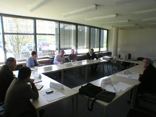
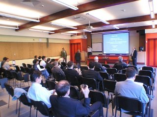
The Lecture Room of the Hotel Manréza in Dobogókő, venue of the Conference
held on 12-13 October 2006. Image: HUNAGI Visuals Resource, 2006

Traditional Fall Events Organised by Bekes Ltd
with presentations and discussions devoted to the latest develop-ments in imaging and mapping in Hungary.

In the first sesssion Peter Winkler and Gábor Mikus of FÖMI RSC delivered lectures on
- Countrywide aerial survey, aerotriangulation, orthophoto production in 2005,
- Land Parcel Identification System for CAP IACS,
- Remote Sensing based control of area-based subsidies, - VINGIS, the GIS basement for the vineyard registry,
- Remote-sensing and LBS used for fight against allergic plants in discovery, interaction and supporting administrative measures,
- Remote sensing in flood and draught monitoring
For more information please visit www.fomi.hu
Image portfolio on the first session: www.hunagi.hu Photo Collection... Events... 2006... November 12-13

Wednesday, October 11, 2006

UN COPUOS acknowledged Hungarian organisations in the Space and Society context


ELTE Space Research Group and HUNAGI were acknow-ledged by the UN COPUOS Report approved by the UN General Assembly in New York

Dr. Előd Both, Director of the Hungarian Space Research Office, Vice President of COPUOS congratulated the Hungarian organisations which were acknowledged in the agenda devoted to Space and Society: aspects education, training and awareness raising at the 49th Meeting of COPUOS held in Vienna last June.
The COPUOS Report (A/61/20) was approved by the UN General Assembly in New York in October 2006. The official document is available at the UNOOSA website:
http://www.unoosa.org/pdf/gadocs/A_61_20E.pdf
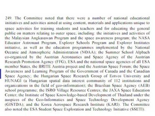
This time two entities of the Hungarian space-related community, the ELTE Space Research Group and the Association for Geo-information (HUNAGI) are among the institutions and organisations which are listed on the pages 36-37 in the resolution number 249.

Tuesday, October 10, 2006

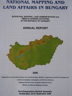
2006 Report on the National Mapping and Land Affairs in Hungary

Cover page of the National Report (c) FÖMI, 2006 Image: HUNAGI Visuals Resource, 2006

Comprehensive Report on the Hungarian activities in Surveying, Mapping, Land Administration and Remote Sensing


The Annual Report was prepared for the EuroGeographics General Assembly held in Amsterdam, 25-27 September 2006.

Contributors are the entities of the National Mapping Agencies as follow:
Department of Land Administration and Geoinformation, Ministry of Agriculture and Rural Development here
Institute of Geodesy, Cartography and Remote Sensing here
Mapping Service of the Hungarian Defence Forces here and the
Ministry of Defence Mapping Company here

The richly illustrated booklet contains information related to the Spatial Data Infrastructure related activities with in-depth overview of the emerging international links including HUNAGI, EUROGI and GSDI.
It is downloadable at the website of the Institute of Geodesy, Cartography and Remote Sensing at here

Friday, October 06, 2006

Spatial Data Stakeholders' presentations at the UNSDI HUCO Kick-off Meeting in Budapest

Mr.Jelle U. Hielkema, consulent of UNGIWG-FAO in action Image: HUNAGI Visuals Resource, 2006

Presentations of the United Nations Spatial Data Infrastructure Hungarian Coordination Office (UNSDI HUCO) Kick-off Meeting
Venue and Date of the Meeting
Based on personalized invitation signed by Dr. Szabolcs Mihály, Director General of the host institute, the Meeting was held on the premises of the Institute of Geodesy, Cartography and Remote Sensing on 28th September 2006.
Hungarian Association for Geo-information presented by Zsolt Sikolya
Hungarian Meteorological Service (OMSZ) presented by Sándor Szalai
Hungarian Space Office, Ministry of Environment and Water presented by Dr. Előd Both
Institute of Geodesy, Cartography and Remote Sensing presented by Dr. Szabolcs Mihály
Hungarian Geological Institute presented by László Orosz
Mapping Service of the Hungarian Defence Forces presented by Lt.Col. István Kádár
Department of Natural Resources, Ministry of Agriculture and Rural Development presented by László Mezei
Department of Land Administration and Geoinformation, Ministry of Agriculture and Rural Development presented by Dr. Szabolcs Mihály
Ministry of Defence Mapping Company presented by Col. László Buga
Ministry of Economy and Transport presented by Róbert Varga
National Directorate General for Disaster Management presented by László Szabó
Research Institute for Soil Science and Agricultural Chemistry presented by Academician Dr.Tamás Németh
University West Hungary Faculty of Geoinformatics presented by Dean Prof.Dr. Béla Márkus
VÁTI Hungarian Public Nonprofit Company for Regional Development and Town Planning presented by Zsolt Barkóczi
The Action Plan of GEO for the years 2007-2009 presented by Gabor Remetey-Fülöpp
FÖMI/HUNAGI Proposal for setting up UNSDI HUCO presented by Dr. Szabolcs Mihály
Some useful references
UNGIWG website with related documents (GeoNetwork, SDI Strategy)
United Nations GI Working Group documents are available at http://www.ungiwg.org
UNSDI related documents
UNSDI documents are available at
http://www.ungiwg.org/unsdi.htm
Related national level coordination offices:
http://www.unsdi.nl , http://www.unsdi.cz
GEO related documents
GEO documents are available at
http://earthobservations.org
Related task documents are available at
ftp://ftp.wmo.int/Projects/GEO/
HUNAGI related documents
HUNAGI documents are available at
http://www.hunagi.hu
and
http://hunagi.blogspot.com , http://hunagi8.blogspot.com

HUNAGI presentation prepared for the GSDI-FIG Session in Munich

Introduction of the organised Hungarian spatial data interest community in the context of SDI and the eGovernment

The presentation will be held by Mrs. Enikő Kovács of FÖMI in the TS-52 Session chaired by Mr. Jarmo Ratia President-elect of GSDI Association, Head of the National Land Survey in Finland.
The ppt version can be downloaded by clicking the main title of this post. The presentation or any part of it may be used in the case if the purpose is to disseminate information on HUNAGI.

Thursday, October 05, 2006

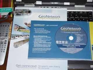
GeoNetwork Opensource for the National Office of Disaster Management in Budapest

GeoNetwork Opensource version 2.0.2 (c) FAO, 2006
UNSDI emphasize GeoNetwork Opensource, a standards based Geographic Data and Information Management System for the web

UNGIWG consultant Mr.Jelle U. Hielkema wrote in his letter: " To get an idea of acual geographic data content through GeoNetwork one will have to go to the individual agency websites, for example www.fao.org/geonetwork ; http://vam.wfp.org/vamsie/srv/en/main.home and www.csi.cgiar.org just to name a few.
Another very informative site is the GeoNetwork Opensource Community website http://geonetwork-opensource.org/ where you will find important additional information."
Within the HUNAGI spatial data interest community, Mr. Viktor Pusztai, President of HUNAGI member EOGEO Foundation said in this context: „Our plan is to find and be involved open source projects mainly connected to environmental systems and GIS applications, and help to bring open source technology closer to the public and Institutions” ( pusztai@eogeo.hu )
Recently a GeoNetwork CD containing a set of opensource softwares was submitted by Mr. Hielkema to the National Office of Disaster Management (OKH), Budapest.

Wednesday, October 04, 2006

UNSDI Hungarian Coordination Office established - Minutes of the Meeting

Newsblog visitors just 8 hours after that this announcement was made Image: HUNAGI Visuals Resource, 2006

UNSDI HUCO Kick-off Meeting authorized HUNAGI to act as Hungarian Coordination Office

Minutes of the United Nations Spatial Data Infrastructure Hungarian Coordination Office (UNSDI HUCO) Kick-off Meeting
Venue and Date of the Meeting
Based on personalized invitation signed by Dr. Szabolcs Mihály, Director General of the host institute, the Meeting was held on the premises of the Institute of Geodesy, Cartography and Remote Sensing on 28th September 2006.
Goal of the Meeting
Based on communication between FAO-UNGIWG Co-chair, Mr.Jeffrey B. Tschirley, FAO-UNGIWG consultant, Jelle U. Hielkema, and the desk officer at the Ministry of Agriculture and Rural Development (MoARD), representing also HUNAGI, Hungary was invited to join the pilot phase of the United Nations Spatial Data Infrastructure (UNSDI) development process.

The opportunity was highlighted in a proposal made by the Department of Land Administration and Geoinformation of MoARD together with FÖMI and HUNAGI and discussed by the Annual meeting of the Hungarian FAO National Committee co-chaired by Dr. LászlóVajda and Ms. Mariann Kovács, leaders of the International and EU Relations at MoARD.
The participants of the Hungarian FAO National Committee agreed unanimously with the proposal to join the UN Spatial Data Infrastructure initiative and authorized Dr. Szabolcs Mihály, Director General of FÖMI to invite the major stakeholders of the Hungarian spatial data providers, value adders and users. Goal of the meeting was to reach a concensus on the establishment of the UNSDI Hungarian Coordination Office and who should be authorized to serve as coordinating body. The date of the UNSDI HUCO Kick-off meeting was scheduled for 28th September.
Participants
Mr. Jelle U. Hielkema represented the United Nations Geographic Working Group (UNGIWG) on behalf of FAO and the World Food Programme (WFP) being the current UNGIWG co-chairs since 2005.
Invited participants
About 16 Hungarian stakeholders have been invited as follow:
Zsolt Barkóczi, Director VÁTI
Dr. Zoltán Bokor, Member of SDI Strategy Task Force, Ministry of Economics and Transport
Dr. Előd Both, Director HSO, MoEW
Dr. Pál Bozó, Director General, Ministry of Environment and Water
Dr. Károly Brezsnyánszky, Director, MÁFI
Col. László Buga Director Mapping Service, Ministry of Defense
Dr. Péter Csóka Director General, Ministry of Agriculture and Rural Development
Dr. Zoltán Dunkel, President, Hungarian Meteorological Service
Gábor Horváth, Director General, Ministry of Agriculture and Rural Development
Dr. Béla Márkus Dean, Faculty of Geoinformation, University West Hungary
Dr. Szabolcs Mihály Director General, FÖMI
Dr. Tamás Németh Director General Research Institute of Soil Science and Agrochemistry of the Hungarian Academy of Sciences
Dr.Remetey-Fülöpp Gábor Advisor of FÖMI, Secretary General of HUNAGI
Zsolt Sikolya President, HUNAGI
Col Gyula Szabó Chief of Service Mapping Service of the Hungarian Defense Forces
Dr. Ilona Szabó Ilona Director General, National Office of Technological Development
Dr.Attila Tatár President, National Directorate General for Disaster Management
Evelin Lantos, Hungarian FAO National Committee
Péter Gresiczki Hungarian UNESCO National Committee
Kálmán Zoltán Permanent Representative of Hungary to FAO in Rome
Jelle U. Hielkema, UNGIWG-UNSDI consultant and lecturer at the UNSDI HUCO Kick-off Meeting
Mariann Kovács Deputy General Director International and EU Relations MoARD
Dr. László Vajda Director General International and EU Relations MoARD
List of Participants
Please see the scanned List of Participants attached. (Available later at www.hunagi.hu )
Apologies:
Evelin Lantos Secretary General FAO HNC
Péter Gresiczki Secretary General UNESCO HNC
Mariann Kovács Deputy General Director International and EU Relations MoARD
Dr. László Vajda Director General International and EU Relations MoARD
Dr.Péter Csóka Director General, Natural Resources, MoARD represented by László Mezei
Attila Tatár Director General National Directorate General for Disaster Management, represented by László Szabó and Erika Cikoráné-Balázs
Dr. Károly Brezsnyánszky Director, Hungarian Geological Institute represented by László Orosz and Gábor Turczi
Pál Bozó Director of Informatics MoEW, represented by Gyula Kothencz and Tamás Lőrincz
Gábor Horváth Director General, Department of Land Administration and Geoinformation, MoARD represented by Dr. Szabolcs Mihály
Dr. Zoltán Dunkel President, Hungarian Meteorological Service represented by Sándor Szalai
Dr. Zoltán Bokor, Member of SDI Strategy Task Force, Ministry of Economics and Transport represented by Róbert Varga
Col Gyula Szabó Chief of Service Mapping Service of the Hungarian Defense Forces represented by István Kádár

Agenda
According to the enclosed Agenda, the GeoNetwork and the UNGIWG-UNSDI initiative, the 'Henricksen UNSDI Implementation Strategy' and the UNSDI Architecture-related newest developments together with the ESA Heterogenous Missions Accessibility (HMA) project were highlighted by the UNGIWG/FAO representative Jelle U. Hielkema, while the Hungarian stakeholders introduced their institution's relevant activities and capabilities according to the following template:
General introduction of the organisation

Highlighting the importance of the SDI from the organisation' viewpoint
Mandated responsibilities related to the EU INSPIRE Annex I-III data
Participation in the Hungarian SDI development with flashback
Ongoing activities in the development/service/use of GI
Highlighting the European and World level professional relations
Highlighting any professional relations with UN organisations
Collaboration on international (including cross-border) projectsin the context
Conclusion: Expectations, expression of support and offered participation in the UNSDI Hungarian Coordination Board
Presentations: formulated expectations and offered contributions
In their presentation, most of the participants gave indication who will be the contact person to the Coordination Board and who will act as appointed contact person in daily operation.

Hungarian Association for Geo-information presented by Zsolt Sikolya
Contact: on UNSDI HUCO Board level:
Zsolt Sikolya
President
Zsolt.Sikolya@ihm.gov.hu,
Tel: +36-1/461-3366
Contact on operational level:
Gabor Remetey-Fülöpp
Secretary General
hunagi@hunagi.hu
Tel: +36-30/4158276
www.hunagi.hu
A golden opportunity to establish an interagency coordination board for SDI in Hungary in mapping and beyond
• National level contribution to the more effective work of the United Nations
• Committed for INSPIRE Principles
• synergy provided by HUNAGI active participation in regional (EUROGI) and global (GSDI) SDI-related existing interdisciplinary networking
If authorized, HUNAGI - via it Secretary General - is ready to run UNSDI Hungarian Coordination Office (HUCO) by
- sending a letter to Mr. Jeffrey B.Tschirley expressing the interest of the agreed participants of this kick-off meeting to participate in the Hungarian pilot for UNSDI
- to coordinate future Hungarian efforts in preparation of the Hungarian pilot for UNSDI
- to register the domain
www.unsdi.hu and prepare webpages for the Hungarian pilot project.
If agreed, the work of HUCO is supervised and supported by the agencies represented at the kick-off meeting (forming the UNSDI HUCO Coordination Board). HUCO reports directly to the UNGIWG and keeps National FAO/UNESCO Committees informed.
Vote on support and willingness to participate UNSDI and to authorize HUNAGI to manage HUCO: yes

Hungarian Meteorological Service (OMSZ) presented by Sándor Szalai
Contact on UNSDI HUCO Board level:
Zoltán Dunkel, President,
dunkel.z@met.hu, +36-1-346-46-66
Contact on operational level:
Sándor Szalai, climatologist
Szalai@met.hu, +36-1-346-46-24
Expectations
-beneficial cooperation for each partner
-overcoming the existing hurdles
-faster development on the international, national and institutional level
Vote on support and willingness to participate UNSDI and to authorize HUNAGI to manage HUCO: will be communicated in written form

Hungarian Space Office, Ministry of Environment and Water presented by Dr. Előd Both
Contact: on UNSDI HUCO Board level:
Dr. Előd Both, Director
both@hso.hu
+36-1/461-3639
Contact on operational level:
Ferenc Horvai
horvai@hso.hu
+36-1/461-3639
HSO Director dr. Both Vice President of UN COPUOS welcomed the proposal.
Vote on support and willingness to participate UNSDI and to authorize HUNAGI to manage HUCO: yes

Institute of Geodesy, Cartography and Remote Sensing presented by Dr. Szabolcs Mihály
Contact on UNSDI HUCO Board level:
Dr. Szabolcs Mihály
Director General, FÖMI
mihaly.szabolcs@fomi.huPhone: +36-1-460-4001
Contact on operational level:
Pál Lévai
senior councillor
levai.pal@fomi.hu
Phone: +36-1-460-4253
FÖMI as the NMCA responsible for the following tasks:
Space referencing data (infrastructure) for all GI
Space referencing geodetic framework
Reference and Projection systems
Geodetic network, GNSS infrastructure
Space referencing base maps
Topographic maps
Cadastral maps
Georeferenced remotely sensed data
According to the judgement of FAO, the preconditions of setting up the national coordination office for UN SDI are given in Hungary too:
- FÖMI has been maintaining professional contacts with FAO for almost two decades, participating in various activities.
Vote on support and willingness to participate UNSDI and to authorize HUNAGI to manage HUCO: yes

Hungarian Geological Institute presented by László Orosz
Contact on UNSDI HUCO Board level:
Dr. Károly Brezsnyánszky
brezsnyanszky@mafi.hu
+36-1/251-4680
Contact on operational level:
László Orosz
orosz@mafi.hu
+36-1/251-0999/194
• Help to manage cross-border issues
• To develop accessibility and comparability of regional/national geoscientific data
• Standards
• Financial support
• Strong willingness in co operation
• Offering the wide professional experience is geosciences
Vote on support and willingness to participate UNSDI and to authorize HUNAGI to manage HUCO: yes

Mapping Service of the Hungarian Defence Forces presented by Lt.Col. István Kádár
Contact on UNSDI HUCO Board level:
Col Gyula SZABÓ, Chief of MS HDF
e-mail: szabo.gyula@mhtehi.gov.hu
Contact on operational level:
Lt Col István KÁDÁR, Deputy Chief of MS HDF
e-mail:
kadar.istvan@mhtehi.gov.hu
Vote on support and willingness to participate UNSDI and to authorize HUNAGI to manage HUCO: yes

Department of Natural Resources, Ministry of Agriculture and Rural Development presented by László Mezei
Contact on UNSDI HUCO Board level:
will be appointed later
H-1054 Budapest, Kossuth tér 11. Hungary
Contact on operational level:
will be appointed later
H-1054 Budapest, Kossuth tér 11. Hungary
The Department has responsibility in planning, survey. State Forest Service and the Hngarian Forest Management maintain the 1:10 k digital forestry cadaster database. They are data provider but user by the way. The Department of Natural Resources MoARD is ready to cooperate.
Vote on support and willingness to participate UNSDI and to authorize HUNAGI to manage HUCO: will be communicated in written form

Department of Land Administration and Geoinformation, Ministry of Agriculture and Rural Development presented by Dr. Szabolcs Mihály
Contact on UNSDI HUCO Board level:
Gábor Horváth Director General
H-1054 Budapest, Kossuth tér 11. Hungary
Phone: +36 1 301-4151, Fax: +36 1 301-4719
›: H-1860 Budapest 55., P.O.B.: 1
horvathg@fvm.hu
Contact on operational level:
Sándor Tóth Deputy Director General
H-1054 Budapest, Kossuth tér 11. Hungary
Phone: +36 1 301-4151, Fax: +36 1 301-4719
›: H-1860 Budapest 55., P.O.B.: 1
toths@fvm.hu
Dr.Mihály informed the participants, DLAG MoARD is interested. It agrees with the proposal and support the activities and ready to cooperate with HUNAGI
Vote on support and willingness to participate UNSDI and to authorize HUNAGI to manage HUCO: yes

Ministry of Defence Mapping Company presented by Col. László Buga
Contact on UNSDI HUCO Board level:
Col. László Buga, director MoD Mapping Co.
H-1024 Budapest, Szilágyi E. fasor 7-9. Hungary
Phone: +36 1 212-0807, Fax: +36 1 212-4223
›: H-1276 Budapest 22., P.O.B.: 85
buga.laszlo@topomap.hu
Contact on operational level:
Dr. László Alabér PhD, technical advisor MoD Mapping Co.
H-1024 Budapest, Szilágyi E. fasor 7-9. Hungary
Phone: +36 1 212-0807, Fax: +36 1 212-4223
›: H-1276 Budapest 22., P.O.B.: 85
alaber.laszlo@topomap.hu
Mr. László Buga expressed their willingness to cooperate
Vote on support and willingness to participate UNSDI and to authorize HUNAGI to manage HUCO: yes


Ministry of Economy and Transport presented by Róbert Varga
Contact on UNSDI HUCO Board level:
Will be appointed later
Contact on operational level:
Will be appointed later
Expectations:
- the ministry will co-ordinate the SDI activities in the field of transport, production/industry, energy and ICT - the ministry will inform the UNSDI HCB about these activities
- however, the effective implementation of SDI activities is the task of different authorities, public and private companies (eg. regarding transport: Infrastructure Business Unit of Hungarian State Railways, Directorate of Road Management, Hungarocontrol…)
Vote on support and willingness to participate UNSDI and to authorize HUNAGI to manage HUCO: will be communicated in written form, several divisions might be interested therefore further correspondance is required to raise awareness of the relevant State Secretaries.

National Directorate General for Disaster Management presented by László Szabó
Contact on UNSDI HUCO Board level:
Mr. László Szabó
chief counsellor
E-mail: l.szabo@katved.hu
Phone: (+36-1/469-4310)
Contact on operational level:
Mrs. Czikora, Erika Balázs
E-mail: cziber@katved.hu
Phone: (+36-1/469-4224)
Expertize in
- decision assistance
- planning and organization
- modelling
- emergency visualization
- emergency exercises (national, international)
- risk analysis and assessment
Vote on support and willingness to participate UNSDI and to authorize HUNAGI to manage HUCO: will be communicated in written form

Research Institute for Soil Science and Agricultural Chemistry presented by Academician Dr.Tamás Németh
Contact on UNSDI HUCO Board level:
Prof. Dr. Tamás NÉMETH director
nemeth@rissac.hu
+36-1/356-4682
Contact on operational level:
József SZABÓ
head of GIS lab
james@rissac.hu
+36-1/356-3694
Expectation: Auxiliary spatial data for spatial soil information systems, everything on soil
Vote on support and willingness to participate UNSDI and to authorize HUNAGI to manage HUCO: yes

University West Hungary Faculty of Geoinformatics presented by Dean Prof.Dr. Béla Márkus
Contact on UNSDI HUCO Board level:
Prof Béla Márkus, dean,
e-mail (geo@geo.info.hu)
Tel (+36-22-516-523)
URL: www.geo.info.hu
Contact on operational level:
Dr Tamás Jancsó, ass. prof.
e-mail (jt@geo.info.hu)
Tel (+36-22-516-545
The University has 13,000 students. Expectation: involvement in capacity building related actions
Vote on support and willingness to participate UNSDI and to authorize HUNAGI to manage HUCO: yes

VÁTI Hungarian Public Nonprofit Company for Regional Development and Town Planning presented by Zsolt Barkóczi
Contact on UNSDI HUCO Board level:
Zsolt Barkóczi, CIO, zsbarkoczi@vati.hu
Contact on operational level:
Géza Juhász IT manager, gjuhasz@vati.hu
Features
• We represent the aspects of data users
• We have connected to the EU INSPIRE programs 2006
• We support all initiatives related to the better utilization and commercialization of spatial data
We offers our experiences in GIS:
• Operation of a complex data warehouse (TeIR)
• The Hungarian (spatial related) data market
• Spatial related data prices, accessibility, precisely
• The licence „problems” related to the GIS data
• Commercial (ArcGIS, AutoCAD…) and Open Source (GRASS) GIS
• Commercial (ArcIMS) and Open Source (UMN Mapserver) web mapping systems
Vote on support and willingness to participate UNSDI and to authorize HUNAGI to manage HUCO: yes

HUNAGI/GSDI
The Action Plan Version 2 of GEO for the years 2007-2009 was highlighted by Gabor Remetey-Fülöpp. The presentation was prepared by Osamu Achiai of GEO Secretariat, and introduced first at the CEOS WGISS-22 Meeting hosted by NASA two weeks ago.

FÖMI/HUNAGI Proposal for setting up UNSDI HUCO
The Proposal for the establishment of UNSDI HUCO was presented by Dr. Mihály, Director General of FÖMI followed by a discussion and vote.
Results of the voting are noted by the represented stakeholders above. The scanned List of Participants also contains the votes registered by the Chairperson.

Wrap-up and conclusions
The participants agreed unanimously with the establishment of the UNSDI HUCO and the selection of HUNAGI and its Secretary General as coordination office and coordinator.
Following the Dutch (UNSDI-NCO) and Czech (UNSDI-CCO) practice, the Chair of the Kick-off Meeting will ask in circular letter all of the stakeholders present to authorize HUNAGI and its Secretary General to act and serve as coordinator. The confirmation should be send back to HUNAGI by October 6, 2006.
It was made clear, that in this preparatory pilot phase there is no need for any commitments related to financial contribution or budget issue.
The Coordination Office will report to the UNGIWG Secretariat whereas the Hungarian National FAO and UNESCO Committees will also be informed on the development. The Coordination Board composed by the delegated contact persons of stakeholders will serve as steering committee. All the presented papers will be available on the HUNAGI website. After official registration all related documents will be available at the UNSDI HUCO’s own site. HUNAGI will circulate an UNSDI HUCO information package among its member organisations by giving opportunity to express non-agreement if any till October 6 as latest.
Finally Mr. Hielkema expressed his impressions for the valuable and diverse content and uniformity of the presentations of the wide range of disciplines, using the UNSDI HUCO logo and template.

Follow-on actions
Jelle U. Hielkema of UNGIWG was received by the Secretary General of the Hungarian National FAO Committee, Ms. Evelin Lantos, and the Deputy Director General responsible for relations with UN agencies in agriculture, Ms.Mariann Kovacs on September 29. The meeting offered excellent opportunity to summarize the results of the Kick-off meeting hosted by FÖMI and sharing personal impressions and expectations.
The Secretary General of the Hungarian UNESCO Committee received the representative of the UNGIWG on 29th September 2006. The talks confirmed the importance of the Hungarian efforts to bring advanced technologies more closely to the implementation of UNESCO tasks via train the trainers in the context of its 'Information for All' Project.
Left: Ms.Evelin Lantos, Secretary General, Hungarian FAO Committee, Mr. Jelle U. Hielkema of UNGIWG and Mrs. Mariann Kovács, Deputy Director General, International Affairs, Ministry of Agriculture and Rural Development Right: Mr. Peter Gresiczki, Secretary General of the Hungarian National UNESCO Committee and Jelle U. Hielkema, representative of UNGIWG Images: HUNAGI Visuals Resource, 2006

Some useful references
UNGIWG website with related documents (GeoNetwork, SDI Strategy)
United Nations GI Working Group documents are available at
http://www.ungiwg.org
UNSDI related documents
UNSDI documents are available at
http://www.ungiwg.org/unsdi.htm
Related national level coordination offices:
http://www.unsdi.nl , http://www.unsdi.cz
GEO related documents
GEO documents are available at
http://earthobservations.org
Related task documents are available at
ftp://ftp.wmo.int/Projects/GEO/
HUNAGI related documents
HUNAGI documents are available at
http://www.hunagi.hu
and
http://hunagi.blogspot.com , http://hunagi8.blogspot.com


Budapest, 2nd October, 2006
Compiled by
Gabor Remetey-Fülöpp
Secretary General, HUNAGI


Tuesday, October 03, 2006

HUNAGI member invited to the eContentplus Meeting hosted by DG InfSo

Stakeholders' consultative meeting
Euroforum, Luxembourg
October 17, 2006
The European Parliament and the Council adopted in 2005 a multi-annual Community Programme, eContentplus, to make digital content in Europe more accessible, usable and exploitable. The programme is implemented through yearly major calls for proposals and has a total budget of 149 million euros, with 93 million euros for the period 2007-2008. Calls have been published in 2005 and 2006. Unit E6 of DG Information Society and Media is responsible for carrying out the programme.DG InfSo is planning to organise a consultation meeting with stakeholders in the area of Geographic Information in Luxembourg on October17th to discuss the continuation of the programme for the remaining years 2007-2008, especially for the call of 2007. This will be done in light of the results of the calls already held, the development of the Geographic Information market and with respect to the political agenda covering the area.
This consultation is held in order to have your views on how one of the main eContentplus objectives of making GI more accessible, usable and exploitable at European level can be achieved. A number of specific points which will be discussed:
1 What is needed in the broad field of GI to achieve the above mentioned objective?2 In which specific GI fields is the difficulty of accessing harmonised data at European level limiting the creation of new products/services and therefore market opportunities?3 Which are the specific spatial data themes where eContentplus can have the maximum impact with the available resources? Why?4 Should eContentplus concentrate on "core-mapping"? Why? Are the resources available sufficient to make an impact in this field?5 Should eContentplus focus on the aggregation/harmonisation of geographic information at European level or have a more "market oriented" approach where the focus is on the creation of new product/services?6 How is it possible to reach (and measure) tangible (data sets, member states, users etc.) and intangible (increased interaction and knowledge sharing) success?
More details including relevant documents:

http://europa.eu.int/information_society/activities/econtentplus/index_en.htm" href=" here__________________________________
European Commission
Information Society and Media DGEuroforum
1180, L-2920 Luxembourg
http://europa.eu.int/econtentplus


The Spatial Data Interest Community of more than 100 Member Institutions


Hungarian Association
for Geo-information
hunagi@hunagi.hu
www.hunagi.hu
tel:+36 30 415 8276

Add me to your address book
Name:

Szakmai önéletrajz (2019.szeptember 9): https://eu1.documents.adobe.com/public/fs?aid=CBFCIBAA3AAABLblqZhCxAu-jWxUHiz2xXAQEQW-hazhHPwo4Qa1zsOyuvS6N3OhX6hjjqGLoZ8XljtLgF7A%2A

Geo Visitors Map
eXTReMe Tracker