Saturday, April 29, 2006

Some selected recent presentations and papers on NSDI, Strategy and HUNAGI

HUNAGI in the Knowledge Management context. Part of the presentation of G. Remetey-Fülöpp at the FIG Conference in Budapest, 27 April, 2006 pdf (2072KB)

Invited Welcome Address on behalf of HUNAGI at the AGILE Conference in Visegrád, Hungary, 20 April, 2006 pdf (64KB)

HUNAGI's presentation on the present stage of NSDI Strategy at the AGILE Workshop on SDIC MORE on Monitoring and Reporting. Budapest, 19 April, 2006 pdf (2963KB)

More presentations on HUNAGI:
Presentations, documents, charts, statistics

Latest version of the HUNAGI in nutshell in English: HUNAGI as the Hungarian Spatial Data Interest Community (as of April 26, 2006) here (800KB)

Remetey-Fülöpp, G.: Crutial Role of GI Associations. In: GIM International, April, 2006 p.65 (c) GITC Insider's View (397KB)
GIM International, the Global Magazine for Geomatics is published by GITC. The author is member of the Editorial Advisory Board of GIM International since the early 90's. Please visit www.gitc.nl for details, incl. subscription.

Friday, April 28, 2006

GI-INDEED a Leonardo Pilot Project participated by two Hungarian partners

Geo-Information in the Implementation of Net-based Distance Education for Environmental Decision Making (GI-INDEED)

University of West Hungary, College on Geoinformatics (GEO) and the Educational and Advisory Institute of MoARD (KSZI) are members of the consortium. The pilot project is funded by the EU Leonardo da Vinci grant in Culture and Education. GEO is a founding member of HUNAGI, while KSZI was just invited to join HUNAGI. The GI-INDEED pilot project's secretariat is hosted by GISIG in Genova, a reputated international GIS Group having mutual partnership with HUNAGI since many years. Its manager Mr. Giorgio Saio was spent some days in Budapest participating the FIG conference. The University of Gavle with Mr. Anders Ostman is the project co-ordinator. The GI-INDEED is one of the first European actions addressed the trainingon the topics of the INSPIRE initiative for various government levels. Other partners include Lantmateriet, ICCOPS, AGILE and the Faculty of Management Science and Informatics of the University of Zilina in Slovak Republic.

CEOS WG Meetings and Hungarian Session between 8-12 May in Budapest


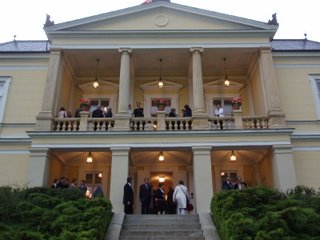
Hotel Gellért Photo: HUNAGI Visual Resource

Forum on EO Applications

Special Session at CEOS WGISS 21 & CEOS WGCV 25 Meetings

Preliminary Forum Program: 10th May, 2006 Wednesday Hotel Gellért, Budapest

08:30 Welcome address Dr. E.Both Director, Hungarian Space Research OfficeSession A08:40 Dr. S. Mihály Chair, DG FÖMI (with introductory words), Co-Chair/Rapporteur: D.Szendrő (DLAG MoARD)08:50 G.Csornai et al (FÖMI) Operational use of Earth Observation in agriculture09:20 G.Büttner – G.Maucha – B.Kosztra: (FÖMI) Application of Earth Observation in Land Cover Mapping and Change Assessments09:50 Peter KacsukGergely Sipos Grid Application Supportby the P-GRADE Portal 10:20 Coffee BreakSession B10:50 Dr. P.Bozó Chair, MoEnvironment and Water (with introductory words), Co-Chair/Rapporteur: K.Brezsnyánszky (MÁFI)11:00 Dr. A.A.Takács – T.Lőrincz - A.Révész (MoEW) et al: Applicability of Satellite Imageries int he Information System for Nature Protection11:30 C.Biró et al (Kiskunság National Park) Use of Earth Observation Data in the Kiskunság National Park, Hungary12:00 M. Biró, Zs.Molnár, F. Horváth: In-door and out-door interpretation of satellite images by botanists12:30 Closing Words (Dr.K.Brezsnyánszky, on behalf of the Geosciences Committee, Hungarian Academy of Sciences chaired by Prof.J.Ádám)

Full program of the week: www.eogeo.hu

Further images:


Two New Proceedings Edited by Prof.Márkus published by the College of Geoinformatics

Cover photo of the two publications. Image: HUNAGI Visual Resources


Books on GI Science as well as e-Government, Knowledge Management and eLearning

edited by Prof.Dr. Béla Márkus were published by WHU GEO, Székesfehérvár in April 2006

Reception given by the Dutch Ambassador

Image: HUNAGI Visual Resources


April 27 - Diplomatic reception offers opportunity to strengthen GI networking


Just one hour later when the scopes and achievements of the Dutch - Hungarian bilateral project on "Technical assistance for institutional building in land consolidation" (TALC) was presented at the session of FIG conference devoted to knowledge management (organised by GEOinfo and MFTTT), the lecturer was in discussion with the agricultural attaché of the Netherlands Mr. Jelle Landstra at the reception given by the Ambassador celebrating the official birthday of Her Majesty Queen Beatrix. The unique atmosphere of this Spring reception is always a good opportunity to develop new domestic links for the benefits of the Hungarian GI Association HUNAGI. It was the case also in 2006.
It was a pleasure to learn, the book of one of the TALC initiator and supporter, the former agricultural attaché Mr. Gábor J.Dzsingisz was just published. More info in the HUNAGI Newsblog http://hunagi8.blogspot.com in Hungarian language.

Thursday, April 27, 2006

FIG Workshop opened in Budapest on 27th April


Daniel Steudler on the e-GEO.CH. Image: HUNAGI Visual Resources

e-Governance, Knowledge Management and eLearning in the focus

More information: www.fig.hu

Hungary is the 64th Member of GEO

The official date when Hungary became member of the Earth Observation Group is April 21, 2006. GEO Secretariat is hosted by the WMO in Geneva.
Listings of the members:
http://www.earthobservations.org/membership/members.html


The Hungarian National GEO Board has a Delegate, a Deputy Delegate and 4 correspondents, one of them is representing HUNAGI.

Friday, April 21, 2006

FIG Workshop in Budapest, April 27-29, 2006

Rubin Hotel venue of the event Image: (c) Google Earth, 2006

Workshop on e-Governance, Knowledge Management and eLearning

Detailed information with Programme etc:
click on the spot title (www.fig.hu)

Thursday, April 20, 2006

9th AGILE Conference on GI Science in Visegrád, Hungary

Prof. Ákos Detrekői welcomes the participants Image: HUNAGI Visual Resources


Shaping the future of GI Science in Europe

Conference statistics featured 62 presentations (among them 7 Hungarian ones) and participants from 25 countries of 4 continents. The Chair of the Welcome Session and the Local Conference Committee Prof. Béla Márkus of the WHU College on Geoinformatics opened the conference. Welcome addresses were given by President of the Hunarian National Committee on Informatics and Telecommunication Prof Á. Detrekői and Secretary General of HUNAGI. The rich program started by the keynote speech of Hervé Jeanjean (CNES) devoted to The European GMES Programme: from concept to reality. The French contribution. The following topics were handled by the parallel sessions:
Earth observation
Interoperability
Spatial data infrastructure
GI issues
Water Management
Geo-visualisation
Semantics and cognition
Decision Support Systems and Spatial Planning
Additional sessions incude Working Group Meetings on Data policy, Education, Environmental Modelling, Urban planning, Interoperability and Useability.
Industry-Science roundtable discussion in plenary was arranged with direct involvement of Bentley, ESRI, Intergraph, PROGIS and DRE. A poster session with more than 15 papers were also scheduled.
The conference proceedings edited by Juan Suarez and Béla Márkus was distributed for the registred participants. Experts from five HUNAGI member institutions delivered presentation including RISSAC, Debrecen University and ELTE. On 20th April, Hungarian Students and their teachers were awarded with Certificate given by HUNGIS Foundation and presents sponsored by GraphIT for their GI-related works

Wednesday, April 19, 2006

AGILE Workshop on Monitoring and Reporting in Budapest

Participants of the Workshop. Image: HUNAGI Visual Resources


The Pre-conference workshop devoted to M&R of SDI hosted by FÖMI was a success

The Workshop chaired by Ewa Wysocka of IGC, Poland attracted 15 enthusiastic participants from 9 countries (P, SP, IT, B, NL, PL, GR, F and HU) plus representative of the EUROSTAT. The AGILE Workshop provided a direct input to the work of the INSPIRE Drafting Teams represented by Marie-Louise Zambon of IGN France and Danny Vandenbroucke of SADL at the Katholieke Universiteit Leuven, Belgium.
Chaired by Szabolcs Mihály, Pasquale Di Donato and Gábor Remetey-Fülöpp, the sessions had the following presentations:
Introduction (E. Wysocka),
Spatially referenced data infrastructure in Hungary (S. Mihály),
The Hungarian NSDI Strategy (G. Remetey-Fülöpp),
The need for Monitoring and Reporting (H. Dufourmont),
INSPIRE SoP: what has been done and what could be done to monitor ESDI (D. Vanderbroucke),
What can be learnt from C/B and RoI studies: outcome of the C/B JRC Workshop (A. Friis-Christensen),
Automatically monitorable indicators in SDI (R. Béjar),
NSD Clearinghouse Worldwide development and impact (J. Bulens),
The monitoring and reporting mechanism in France (M-L. Zambon),
Internal monitoring and reporting tools for Regional SDI implementation (P. Di Donato).
The sessions generated Q/As and in the afternoon break-out session two working groups compiled teamwork based answers on 5 questions formulated by E.Wysocka, P. Di Donato and D. Vanderbroucke in the subjects related to indicators and monitoring. The Workshop was a success. The presentations will be available in one week on the official AGILE website.

Tuesday, April 11, 2006

Hungarian Segment of the CEOS Meeting

Hotel Gellért Photo: HUNAGI Visual Resource


Forum on EO Applications

Special Session at CEOS WGISS 21 & CEOS WGCV 25 Meetings

Preliminary Forum Program: 10th May, 2006 Wednesday Hotel Gellért, Budapest

08:30 Welcome address Dr. E.Both Director, Hungarian Space Research Office
Session A
08:40 Dr. S. Mihály Chair, DG FÖMI (with introductory words), Co-Chair/Rapporteur: D.Szendrő (DLAG MoARD)
08:50 G.Csornai et al (FÖMI) Operational use of Earth Observation in agriculture
09:20 G.Büttner – G.Maucha – B.Kosztra: (FÖMI) Application of Earth Observation in Land Cover Mapping and Change Assessments
09:50 Jjiang-G.Remetey-P.Winkler (ISPRS WG IV/1) Earth Observation Data and Services in National Spatial Data Infrastructure
10:20 Coffee Break
Session B
10:50 Dr. P.Bozó Chair, MoEnvironment and Water (with introductory words), Co-Chair/Rapporteur: K.Brezsnyánszky (MÁFI)
11:00 Dr. A.A.Takács – T.Lőrincz - A.Révész (MoEW) et al: Applicability of Satellite Imageries int he Information System for Nature Protection
11:30 C.Biró et al (Kiskunság National Park) Use of Earth Observation Data in the Kiskunság National Park, Hungary
12:00 M. Biró, Zs.Molnár, F. Horváth: In-door and out-door interpretation of satellite images by botanists
12:30 Closing Words (Dr.K.Brezsnyánszky, on behalf of the Geosciences Committee, Hungarian Academy of Sciences chaired by Prof.J.Ádám)

Full program of the week: www.eogeo.hu

Further images: http://www.fomi.hu/hunagi/pdf/2004/photos/cities/HotelGellert/index.html

Monday, April 10, 2006

CEOS WGISS 21 & CEOS WGCV 25 Meetings in Budapest

CEOS Preliminary Program Available

The active Hungarian participants (invited VIPs, experts and decision makers, lecturers, session chairs and moderators) as well as limited number of interested technical representatives of institutions and organisations active in the development and applications of the Earth Observation are welcomed to register at http://www.eogeo.hu:8080/registration
The participation registration fee is based on daily fee (40 euro/person/day). Working language is English. For details please visit www.eogeo.hu

Saturday, April 08, 2006

HUNAGI applied for grant of the National Civil Fund

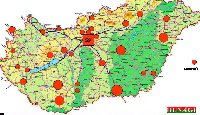
HUNAGI Members' Geographical Distribution. Image: HUNAGI Visual Resources

HUNAGI applied for grant of the National Civil Fund

Applications were submitted before deadline in two categories: supporting HUNAGI's memberships in European and Global organisations (EUROGI and GSDI respectively) as well as partially supporting the daily operations.
More on HUNAGI: www.hunagi.hu
More on EUROGI: www.eurogi.org
More on GSDI: www.gsdiassociation.org
By agreement, HUNAGI has membership also in the Genova based GISIG and keeps MoU based partnership with the Hungarian Society of Logistics (MBLKT)

Friday, April 07, 2006

Preparing for eContentPlus - A, CZ, HU, SLK

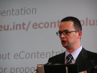
Federico Milani of the EC eContentplus Programme in action. Image: HUNAGI Visual Resources


2nd Orientation and Matching Day
Millenium Park, Budapest
April 7, 2006


The programme was primarly devoted to Digital libraries: Scientific/Scholarly Content, but many of the participants used the opportunity to discuss the topic Geographic Information. Moderated by the Hungarian Association of Content Industry (MATISZ) all aspects were highlighted. The Czech and Hungarian National GI Associations (CAGI and HUNAGI) were represented on President and SG level, while the high profile participation of EFITA with President Karel Chravat, PROGIS with CEO Walter Mayer, FÖMI with Deputy DG Peter Winkler was a clear indication of the interest of NGOs, Private and Public Sector in the Spatial Data Community.

Networking during the lunch break: consultation of potential partners.

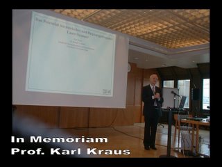
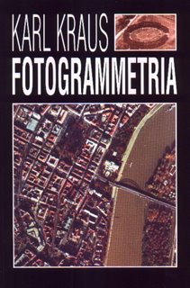
Death of Prof. Karl Kraus

Prof K.Kraus delivered lecture on the topographic application of aerial and spaceborne laser scanning at the AGEO Annual Day in November 2001. Image: HUNAGI Visual Resources


The death of Prof. Karl Kraus is sad loss also for the Hungarian GIS/RS community

We learned by deep regret from ISPRS Secretary General Orhan Altan about the death of Prof. Karl Kraus, following a heart attack while he was at the Turkish German Joint
Geodetic Days in Berlin on 30 March 2006. Karl was Professor of the Institute of
Photogrammetry and Remote Sensing at the Technical University in Vienna
and Congress Director for the Vienna ISPRS Congress in 1996.
The Hungarian translation of his excellent textbook on Photogrammetry was initiated by Peter Winkler of FÖMI and Ákos Detrekői of the Budapest University of Technology and Economics. This book is still the textbook of university and college students in Hungary. Prof. Kraus was a visioner and initiator and supporter of many new developments and ideas in
photogrammetry and remote sensing. He was close to the Hungarian community of photogrammetrists and remote sensing experts and his death is a sad loss also for us.


Cover page image: HUNAGI Visual Resources by the courtesy of P.Winkler

Thursday, April 06, 2006

Board of GEO National Officers established

Some of the participants of the Meeting. Image: HUNAGI Visual Resources

Inaguaral Meeting of the Board of GEO National Officers chaired by GEO Principal Dr. István Erényi on April 6, 2006


The Board will consist representatives of the MoIC (Dr.I.Erényi, Principal), Hungarian Meteorological Service (Dr.Z.Dunkel, Principal, Alternate) and four Correspondents representing MoEnvironment and Water (P.Bozó), MoAgriculture and Rural Development (Dr.Sz.Mihály) as well as the Hungarian Space Research Office (Dr.E.Both) and HUNAGI (Dr.G.Remetey-Fülöpp). For official announcement please visit www.ihm.gov.hu

CEOS WGISS&WGCV Meetings in Budapest

CEOS WGISS&WGCV 2005 Meeting Participants in Cordoba, Argentina. Image: HUNAGI Visual Resources Photo courtesy by Mr.Viktor Pusztai of EOGEO Hungary


CEOS WGISS and WGCV
members will meet next
in Budapest, Hungary
May 8-12, 2006

Preliminary Programme will follow soon

First Call: 16th National GIS Conference in Szolnok, Hungary

A konferencia hagyományos helyszíne. Kép: HUNAGI fotogyűjtemény (2001)


Első felhívás: 16. Országos Térinformatikai Konferencia (OTK)

A térinformatikai alkalmazások egyik legjelentősebb hazai rendezvényére kerül sor 2006. szeptember 28-29-én, tizenhatodik alkalommal Szolnokon, a felújított régi helyszínen a Városi Művelődési és Zenei Központban.
Bővebbet a HUNGIS honlapján itt Sajtóhír itt (181 KB)
Date and venue: 28-29 September, 2006, City Cultural and Music Centre, Szolnok, Hungary
More information: here Press release here (181 KB)


Wednesday, April 05, 2006

Active GNSS network for Hungary

Az elkészült terv jelenlegi változata Image: HUNAGI Visual Resources, by the courtesy of FÖMI
(c) FÖMI SGO, 2006


Valós idejű országos RTK szolgáltatás kiépítése


Tagintézményünk a FÖMI nagypontosságú műholdas helymeghatározást országosan lehetővé tevő korrekciós jelsugárzás kiépítésével kapcsolatos megvalósítási tervét kívánja tovább fejleszteni, amely a helyzetfüggő szolgáltatásokhoz biztosítana infrastuktúrát az érintettek bevonásával és összefogásával.

Tekintettel a műholdas helymeghatározás és navigáció világméretű, nagyszabású programjára (GNSS) annak keretében az Európai Unió és az Európai Űrügynökség által közösen fejlesztett GALILEO programjára, valamint arra, hogy a téradat-ellátottság és minősége az információs társadalom stratégiájában alapvető indikátorként lett elfogadva, a GNSS infrastruktúra mielőbbi országos kiépítése a fenntartható fejlődést közvetlenül szolgálni képes.

A valósidejű RTK szolgáltatások bevezetése egy sor alkalmazás előtt nyitja meg az utat a helyfüggő szolgáltatások lehetőségén keresztül az agrárlogisztikától kezdve az állategészségügyi intézkedések támogatásán át a fenntartható vidékfejlesztésig és közvetlenül kihat a lefedéssel érintett területek gazdasági életére, hozzájárulva a kis-és közepes méretű vállalkozások, ezzel új munkahelyek számának növeléséhez.

Az egyenlő esélyek biztosítása, valamint a hátrányosabb térségek felzárkóztatása érdekében a valós területi igények felmérésével, ismeretében folyik a FÖMI-nél a homogén országos területi lefedés kiépítésének tervezése, üteme és feltételei. Ennek keretében a szolgáltatás-ellátottság tervezett alakulását naptári évekre lebontva az elsődleges felhasználók és érintett szervezetek, intézmények számára célszerű megismertetni azzal, hogy a megvalósítás időbeli sorrendjén a feltételek korábban történő biztosításával változtatni lehet. Ilyen intézmények a teljesség igénye nélkül egyes központi intézmények: katasztrófaelhárítás, határőrség, a logisztikai szervezetek, sűrgősségi szolgálatok, továbbá a helyi önkormányzatok, kistérségi szervek, decentralizált szakági szervezetek (vízügy, erdészet, növényegészségügy és talajvédelem stb).
Az igényfelmérésben működhet közre a HUNAGI, mint nem-kormányzati, non-profit térinformatikai közösség, felhasználva kiterjedt belföldi információs hálózatát.
A csatolt kép mutatja a kiépítés jelenlegi és a közeljövőben tervezett megvalósítási szakaszát az állomásokkal és a szolgáltatással lefedett területtel.
Kérem, hogy észrevételeit, megalapozott igényeit, hozzájárulásának formáját és lehetőségeit közvetlenül a következő címre küldje: borza@sgo.fomi.hu (Dr. Borza Tibor FÖMI KGO vezetője részére) . Tagszervezeteink és tagintézményeink tömör, szakszerű visszajelzései nagyban előmozdíthatják a fejlesztés megvalósíthatóságát. A folyamat iteratív és a fejlődést a HUNAGI blogja - együttműködve a FÖMI-vel és az ITKTB Műholdas Navigáció Albizottságával - folyamatosan láttatni fogja.

HUNAGI interactive blogs in Hungarian language launched

A HUNAGI magyar nyelvű interaktív blogokat indított.

Ezek sikere attól függ, akadnak-e önkéntes szerkesztő-társak, moderátorok tagjaink közül a Nemzeti Téradat Infrastruktúra Stratégia, az NTIS által kijelölt fő irányokban:

1) jogszabályok és adatpolitika;
2)téradat-szabványok és adatbázis specifikációk;
3) téradat ellátottság, téradatok létrehozása és változásvezetése;
4) metaadatok szolgáltatása és a téradatokhoz való hozzáférés biztosítása;
5) térinformatikai ismeretek elsajátítása, a térinformatika alkalmazása az oktatás teljes vertikumában;
6) magyar közreműködés az euróatlanti szervezetek és intézmények munkájában.

Mindezeken felül:
7) tervezett, folyamatban lévő és befejezett alkalmazások, fejlesztések;
8) egyéb figyelemfelhívás (események, dokumentumok, kiadványok, akciók);
9) Civil szerveződés keretei között megfogalmazott és a HUNAGI, mint a JRC SDIC szervezete által továbbítandó felhasználói javaslatok, megjegyzések az Európai Bizottság számára.
10) Szaknyelvi szókincs és szóhasználat


Az 1-6 blogokhoz a HUNAGI önkéntes társszerkesztők jelentkezését várja a hunagi@hunagi.hu címre max 3 terület prioritás szerinti sorrendben való megjelölésével, 2006. április 21-ig.
A blogok pontos címe ezt követően kerül nyilvánosságra, olyan sorrendben ahogy az önkéntes szerkesztők rendelkezésre állnak.
Az 1-6 témakörök tartalmi leírását maga az NTIS fogalmazza meg.
A 7-9 témakörök tartalmáért a hozzájárulást tevők felelősek.

Már van társzerkesztője az 5) témakörnek és folyamatban van a 2) és 10) visszaigazolása.
Várjuk a HUNAGI térinformatikai közössége tagintézményeiből, tagszervezeteiből a szakértők és diáktagság aktív részvételét!

Az NTIS vitaanyag szakaszban áll, a munkadokumentum a HUNAGI honlapjáról (www.hunagi.hu ) és az ITKTB honlapjáról (www.itkht.hu ) egyaránt elérhető.

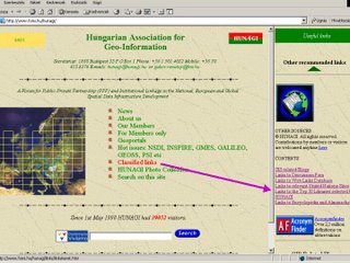
Hungarian GI Community served by HUNAGI with access to the best of Digital Libraries available worldwide

Access to Digital Libraries on the HUNAGI website. Image: HUNAGI Visual Resources


Improved
e-content of HUNAGI homepage with access to the world's leading Digital Libraries and Catalogs


Based on research and careful selection, HUNAGI homepage provides for its visitors direct access to 50+ acknowledged digital libraries including the most prominent ones.

Magyar olvasók: észrevételeket, kiegészítéseket, kapcsolódó figyelemfelhívást a comments-re klikkelve lehet megadni, természetesen magyar nyelven is! Figyelembe veendő, hogy ez a blog - a HUNAGI küldetésének megfelelően - elsősorban az euróatlanti partnerek tájékoztatását szolgálja a hazai vonatkozású hírekkel, tagszervezeteink, tagintézményeink eredményeinek láttatásával.
A HUNAGI tisztán magyar nyelvű interaktív blogokat is indít. Ezek sikere attól függ, akadnak-e önkéntes szerkesztő-társak, moderátorok tagjaink közül a Nemzeti Téradat Infrastruktúra Stratégia, az NTIS által kijelölt fő irányokban: 1) jogszabályok és adatpolitika; 2)téradat-szabványok és adatbázis specifikációk; 3) téradat ellátottság, téradatok létrehozása és változásvezetése; 4) metaadatok szolgáltatása és a téradatokhoz való hozzáférés biztosítása; 5) térinformatikai ismeretek elsajátítása, a térinformatika alkalmazása az oktatás teljes vertikumában, 6) magyar közreműködés az euróatlanti szervezetek és intézmények munkájában.
A HUNAGI önkéntes társszerkesztők jelentkezését várja a hunagi@hunagi.hu címre max 3 terület prioritás szerinti sorrendben való megjelölésével, 2006. április 21-ig.

Hungary: EO/GNSS and the natural disater mitigation

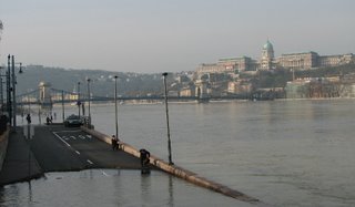
The cresting Danube at Budapest today. Photo taken on 5th April 2006 at 8 am. Image: HUNAGI Visual Resources.


Highwater in Hungary !


The major rivers in Hungary, namely the Danube and Tisza are expected to crest today with a highest ever-recorded level. The Danube bend is exceptionally heavely impacted: many of the villages are isolated by the highwater and experiences limited accessibility.
The use of earth observation and satellite positioning techniques and service capabilities developed during the previous decades available at FÖMI is expected to be highlighted by the opening speech of Dr. Norbert Berczi, Deputy State Secretary of MoARD at the opening of the CEOS WGISS & WGCV Meeting held in Budapest between 8-12 May 2006.
More on the CEOS Budapest events: http://www.eogeo.hu

Sunday, April 02, 2006

EUROGI Members' Day in Brussels

Anett Huber of Intergraph in action Image: HUNAGI Visual Resources


EUROGI members met representatives of five European Commission DGs and with top GI market players

The Members'Day were represented among others by Hugo De Groot of DG Envi, Krister Olson of DG InfSo, Wolfgang Steinborn of GMES/DG Enterprise and Industry, Maresa Meissl DG InfSo & Media, Vincent Gabaglio of Galileo Joint Undertaking, as well as managers of Autodesk, ESRI Europe, Intergraph, LaserScan and Navteq
Photo documentation already on-line: www.hunagi.hu (Photo Collection...Events)

Saturday, April 01, 2006

Diáktagokat vár a HUNAGI

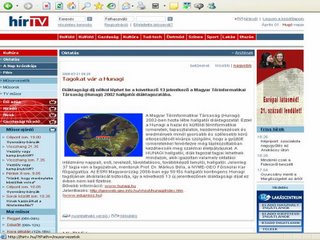
HUNAGI on the webpage of the Television Broadcast Company Hír TV(c) HírTV


Diáktagsági díj nélkül léphet be a következő 13 jelentkező a Magyar Térinformatikai Társaság (Hunagi) hallgatói diáktagozatába.


A Magyar Térinformatikai Társaság (Hunagi) 2002-ben hozta létre hallgatói diáktagozatát. Ezzel a Hunagi a hazai és külföldi térinformatikai ismeretek, tapasztalatok, kezdeményezések és eredmények minél gyorsabb és szélesebb körű elterjesztését kívánja szolgálni, hogy a gyűjtött ismeretekkel felvértezve még tájékozottabban kezdhessék meg szakmai életpályájukat. A HUNAGI hallgatói, diák tagozat tagjai lehetnek mindazok, akik igazoltan valamely oktatási intézmény nappali, esti, levelező, távoktatásos, továbbképző tanulói, hallgatói. Jelenleg 37 tagja van a tagozatnak, mentoruk Prof. Dr. Márkus Béla, a NYME-GEO Főiskolai Kar főigazgatója. Az ESRI Magyarország 2006-ban egy 50 fős hallgatói kontingens Hunagi tagdíjának átvállalását biztosítja, így a következő 13 új jelentkezőnek diáktagsági díjat ez évben nem kell fizetnie. Bővebb információ: http://www.hunagi.hu/Jelentkezés: http://geoweb.geo.info.hu/vhost/hunagi/index.htm .(http://www.edupress.hu/)

European Council WPE on INSPIRE

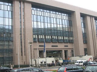
Justus Lupius Building of the European Council in Brussels Image: HUNAGI Visual Resources


EUROGI General Assembly was informed by first hand on the latest development by experts who took part both events.

The Council Working Party on Environment Meeting was held on 30th March. Subject was
to discuss the shift of Cadastre and Address from INSPIRE Annex II to Annex I.
These changes were suggested by the Permanent Committee on the Cadastre of the EU; and the amendments 35, 34, 33, 32, have been introduced in “Draft Recommendation for second reading by the European Parliament”. (doc ) More on INSPIRE: http://inspire.jrc.it/
Some of the former and present EUROGI executive committee members are nominated country GIS representative in the INSPIRE Expert Group of the European Commission including Francois Salgé (France), Antti Vertannen (Finland), Sebastian Mas-Mayoral (Spain), Bruce McCormack (Ireland) and Gabor Remetey-Fülöpp (Hungary).


The Spatial Data Interest Community of more than 100 Member Institutions


Hungarian Association
for Geo-information
hunagi@hunagi.hu
www.hunagi.hu
tel:+36 30 415 8276

Add me to your address book
Name:

Szakmai önéletrajz (2019.szeptember 9): https://eu1.documents.adobe.com/public/fs?aid=CBFCIBAA3AAABLblqZhCxAu-jWxUHiz2xXAQEQW-hazhHPwo4Qa1zsOyuvS6N3OhX6hjjqGLoZ8XljtLgF7A%2A

Geo Visitors Map
eXTReMe Tracker