Saturday, January 28, 2006

New DG appointed for the Department of Land Administration and Geoinformation

Photo: HUNAGI Visual Resources

New Head on the top of the Hungarian Land Registry, Mapping and Cadastre

Former Deputy Head Mr. Gabor Horvath has been appointed as new Head of the Department of Land Administration and Geoinformatics at the Ministry of Agriculture and Rural Development. (On the picture left, with Alexei Overtchuk right, Co-Chair of the UNECE Working Party on Land Administration.) More details later: here

4 Countries Initiative Preparing for eContentplus - Hungary involved

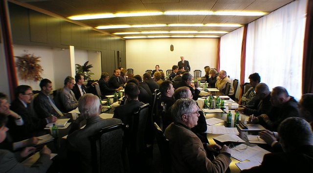
Photo: HUNAGI Visual Resources

Preparing for eContentplus - Geographic Information Systems
Prague, February 9-10 2006

From the eContentPlus.net Newsletter, 23 January 2006: The availability of high quality geographic information and the development of advanced Geographic Information Systems which make these content assets more accessible are significant segments of the digital content market in Europe. The opening event of the 4 countries’ initiative Preparing for eContentplus (A, CZ, HU, SK) – 1st Orientation- and Matching Day - dedicated to GIS underlines the importance of the topic itself and will overview of the access to and use of public sector information in domains such as transportation, environment, tourist information, agriculture etc. The further target is to improve cross border cooperation aiming at the better accessibility and reuse of geographic information. The Orientation and Matching-Day offers four elements to you:
1. The Focus Topic: What are current developments in the GIS-sector? Which proven models are in use? Where are protentials and challenges? 2. The European Programme eContent plus: What are the emphases? What will be funded? What are the next steps? 3. The Central Europeam Markets: What are the characteristics of the four markets? Who are the players? 4. Matching-Support: Do you want to get to know the markets or develop projects? The initiative will offer you support finding central european partners.
Recommended by HUNAGI in conjuction with the Ministry of Informatics and Communication, Hungary will be represented by Dr. Szabolcs Mihály, DG of the Institute of Geodesy, Cartography and Remote Sensing. For more information please contact info@econtentplus.net

Tuesday, January 24, 2006

Inaugural Meeting of ITS Hungary

Photo: HUNAGI Visual Resources

ITS (Intelligent Transportation Systems) Hungary established


About 30 invited potential founder organisations including some GIS companies (Geometria, Topolisz, 7pont) and HUNAGI participated the inaugural meeting hosted by the Ministry of Economics and Transportation in Budapest, on 24th January 2006. The aim was to establish ITS Hungary. The new organisation will be the Hungarian member of the Network of National ITS Associations coordinated by the Intelligent Transport Systems and Services Europe (ERTICO). The application procedure for court registration will start in early February. President and Secretary General elected are Mr.Lajos Szűcs of MoE&T and Prof.Dr. Ágnes Lindenbach of Budapest University of Technology and Economics. Prof.Dr. Ákos Detrekői has been elected as one of the Honorary Presidents. More details will follow soon Posted by Picasa

Hungarian Project awarded by GSDI and GIS Corps

Photo: HUNAGI Visual Resources
Hungarian success in the GSDI Annual Small Grants Program


For the call of the Global Spatial Data Infrastructure Association relayed by HUNAGI, the grantee "Botany Portal" , a new project of MTA OBKI (the Institute for Ecology & Botany of the Hungarian Academy of Sciences) was awarded by and received a grant of $2,500 in funding from GSDI supplemented with voluntary services from the GIS Corps. The website of OBKI's recent META project called Mapping Hungary's landscape for vegetation, and is referenced as the Website of the Week in the News column of HUNAGI website here . MÉTA project was put on the WebCastle site devoted to "GI Cases illustrating the benefit of use of GI/GIS for the Society" recently www.eurogi.org

Monday, January 23, 2006

International Conference on GI Science in Europe hosted by Hungary

Photo: HUNAGI Visual Resources


9th Annual Conference of AGILE in Visegrád, Hungary


The 9th AGILE International Conference on Geographic Information Science with the theme "Shaping the future of Geographic Information Science in Europe" will be held in Hungary between 20-22 April, 2006.
For more information please visit http://www.agile2006.hu/

International Workshop on e-Governance, Knowledge Management and e-Learning in Hungary

Photo: HUNAGI Visual Resources

FIG Workshop hosted by Hungary in Spring 2006


Organized jointly by FIG Commission 2 (Professional Education), FIG Commission 3 (Spatial Information Management) and FIG Commission 7 (Cadastre) on e-Governance, Knowledge Management and e-Learning, a FIG Workshop will be hosted by Hungary between April 27-29, 2006.
For additional information please visit: http://www.fig.hu

The Host is the College on Geoinformatics, University of West Hungary, a member institute of HUNAGI

Sunday, January 22, 2006

Budapest hosts CEOS WGISS/WGCV Meetings in May 2006

Photo: HUNAGI Visual Resources
CEOS WG Meetings first time in Hungary


Two Working Groups of CEOS, the Committee on Earth Observation Satellites will held their Plenary and Subgroup Meetings in Budapest, Hotel Gellért, between 8-12 May, 2006.Conference registration and further details here More on the Committee on Earth Observation Satellites here More on the Working Group on Information Systems and Services here More on the Working Group on Calibration and Validation here Organisers: EOGEO Hungary, United Nations and HUNAGI under the local auspice of the Hungarian Space Research Office.

Saturday, January 21, 2006

The Hungarian National GI Association, HUNAGI

Image: Google, 2005

Budapest, location of the Secretariat of HUNAGI, the Hungarian Association for Geo-information. This interdisciplinary umbrella organisation has more than 100 institutions and organisations as member covering the governmental, academic and private sectors including NGOs. Established in 1994, HUNAGI has full membership both in the European Umbrella Organisation for Geographic Information (Lisbon, Portugal) and Global Spatial Infrastructure Association (Reston, Va. USA) . The number of the visitors of the English-language HUNAGI website were doubled during the past two years ( http://www.hunagi.hu )
It holds a comprehensive Links & News Database and a wide Collection of Visual Resources Posted by Picasa


The Spatial Data Interest Community of more than 100 Member Institutions


Hungarian Association
for Geo-information
hunagi@hunagi.hu
www.hunagi.hu
tel:+36 30 415 8276

Add me to your address book
Name:

Szakmai önéletrajz (2019.szeptember 9): https://eu1.documents.adobe.com/public/fs?aid=CBFCIBAA3AAABLblqZhCxAu-jWxUHiz2xXAQEQW-hazhHPwo4Qa1zsOyuvS6N3OhX6hjjqGLoZ8XljtLgF7A%2A

Geo Visitors Map
eXTReMe Tracker