Friday, March 31, 2006

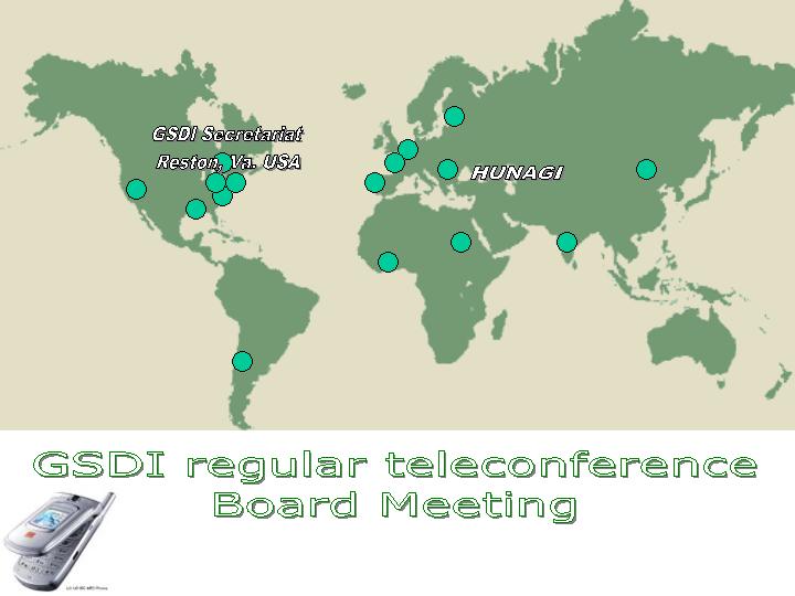
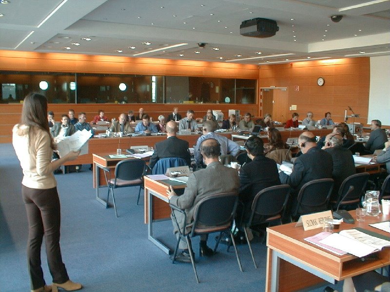
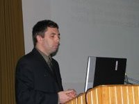
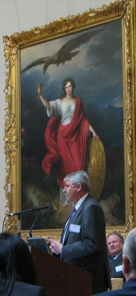
HUNAGI participated EUROGI's Annual Board Meeting

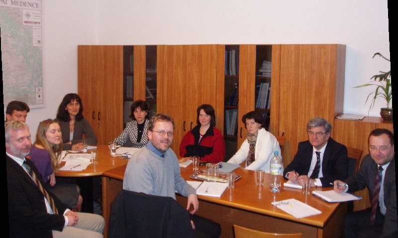
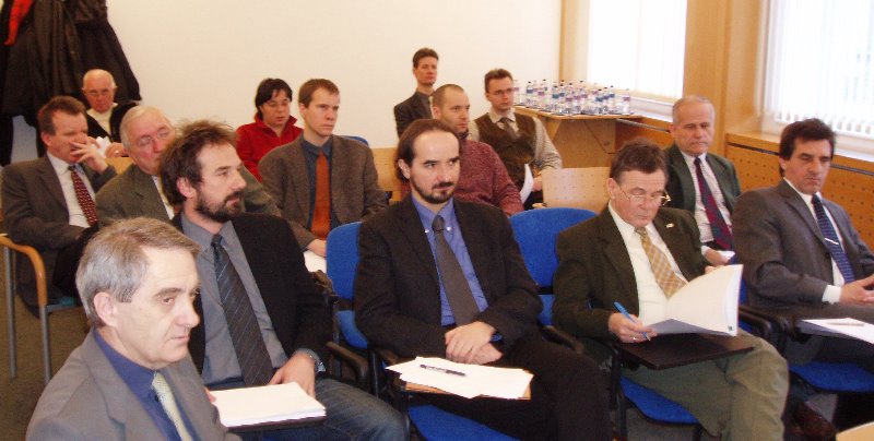
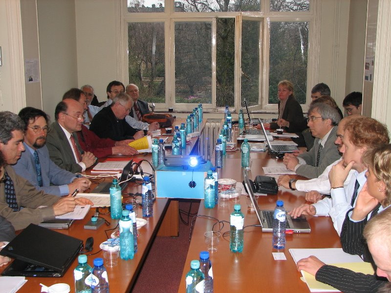
Some of the participants. Image: HUNAGI Visual Resources

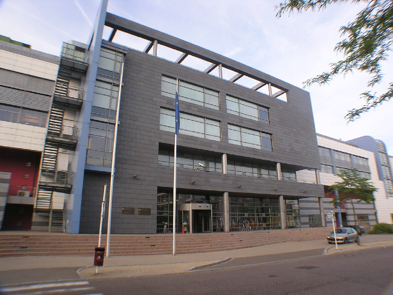
At the AGM 2006 held in Brussels on 31st March, HUNAGI made contributions to EUROGI Actions

First after 9 years, no representative from the New EU Member States has seat in the Executive Committee. HUNAGI is active in the Working and Advisory Groups, which are the main drivers of the Organisation. HUNAGI representatives serves as advisor for the Secretary General of EUROGI in international affairs with special emphasis on Central and Eastern Europe.
HUNAGI representatives expressed his deep concerns related to the voting weights applied and urged revisit the system as soon as possible.

HUNAGI called the attention on the role of the organised GI communities ie. the national GI associations and EUROGI as potential partners of the European Economic and Social Committee in reaching the Lisbon Goals. The preliminary links have been established at the EESC Conference held in the Budapest Parliament some weeks ago.
HUNAGI made recommendation to improve the communication of EUROGI and its member organisations introducing a uniform interactive webblog optimized for increase theInternet search engine hits and providing better visibility for the keyword "Geospatial". The system introduced by HUNAGI late January verified the efficiency. The details were shared with the AGM participants.
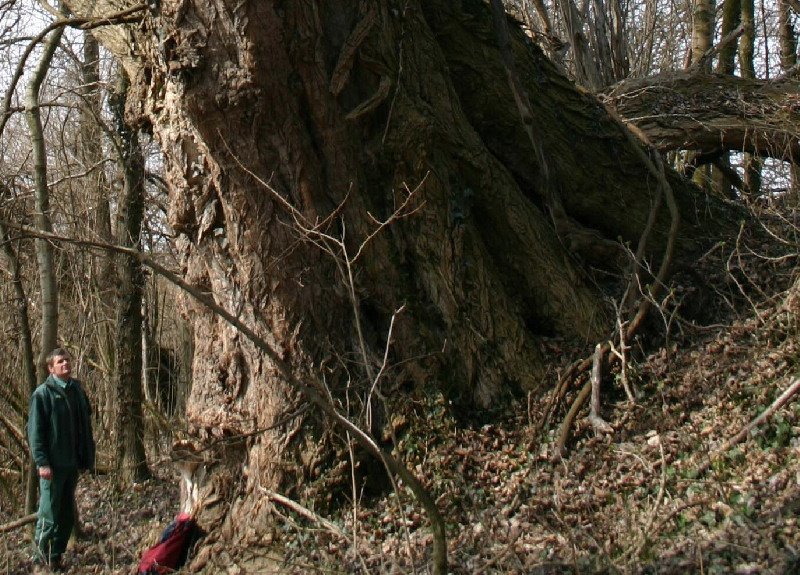
The European Inventory on the Large Trees using methodology elaborated in Hungary was also formally introduced. President of EUROGI asked HUNAGI to prepare the follow up directly with the Secretary General Joao Geirinhas.
The up-to-date 2-side leaflet on HUNAGI activities and its members were distributed for the participants.


Report will come soon
More on HUNAGI: www.hunagi.hu

Tuesday, March 28, 2006

GSDI Board Teleconference Informed on CEOS Meeting

Geographical distribution of GSDI Board Members Image: HUNAGI Visual Resources


The teleconference was started with HUNAGI participation at 15:00 hours CET on 28th March, 2006


Outcome of the Meeting relevant to the HUNAGI community will be summarized here soon

More on GSDI: www.gsdiassociation.org

Hungarian Space Research Council held Meeting today

The Meeting was chaired by the Minister of Information and Communication Image: HUNAGI Visual Resources


Call for Participation: ASA Alpbach Summer School

A Magyar Űrkutatási Iroda híre nyomán:
"Alpbachi Nyári Iskola 2006 - Az Osztrák Űrügynökség 2006. július 25. - augusztus 3. között rendezi szokásos nemzetközi nyári iskoláját Alpbachban. A tábor idei témája a természeti veszélyforrások világűrből történő megfigyelése. Az űrügynökség honlapján már szerepel a részletes felhívás (www.ffg.at/index ). A jelentkezési határidő: 2006. március 31. (Hivatalos formában jelentkezni az oszrák honlapról letölthető Announcement of Alpbach 2006 dokumentumban található jelentkezési lap kitöltésével lehet.) A nyári iskolának első alkalommal lesznek magyar előadói. Amennyiben szükséges, a MŰI (http://www.hso.hu/ )valószínűleg részben vagy egészben tudja támogatni kiutazó fiatalok regisztrációs díját, mely idén 330 euró."
Mint az 1989.évi Alpbachi Nyári Iskola hallgatója csak ajánlani tudom minden a földmegfigyelés alkalmazásai témakör iránt érdeklődőknek, főleg a HUNAGI posztgraduális hallgatóinak a részvétel módja iránti alaposabb tájékozódást, mert akár egy fél életre szóló municióhoz lehet jutni.
A lehetőségről a Magyar Űrkutatási Tanács ma délutáni ülésén is szó esett és dr.Both Előd úr, a MÜI igazgatója javaslatára a magyar térinformatikai közösség figyelmét ezúton is felhívjuk e lehetőségre
rfg

Hungarian presentation on Databases and Data Services at EUROSTAT Workshop

The building hosting EUROSTAT on Kirchberg in Luxembourg. Image: HUNAGI Visual Resources


Hungarian presentation at the Working Party "Geographical Information Systems for Statistics" in Luxembourg on 16 and 17 March 2006.

The joint meeting of the National Statistical Institutes with the National Mapping Agencies was hosted by EUROSTAT. In the topic Other National/Regional experiences in Member States, the Databases and Data Services at NMA of Hungary was introduced by Mr. Pál Lévai of FÖMI and Károly Tóth of HCSO. Extract of the summary minutes compiled by the Commission:
"A comprehensive presentation on the organisation of the Hungarian National Mapping Agency, as well as of the applicable regulations and of the available data and services was given. Hungarian NMA depends from the Ministry of Agriculture and Rural Development, being part of the Main Department of Land Affairs and Geoinformatics. A number of alphanumeric, raster and vector databases are maintained, as well as services for supporting National and European legislative provisions, public and private sector user needs. The INSPIRE initiative is closely followed, both at the level of legislative process and working programme for the preparatory phase; many presentations were given in national and international conferences presenting INSPIRE and the position and contribution of Hungary. Some examples of cooperation with the Hungarian National Statistical Institute were finally presented."

Both FÖMI and the Hungarian Central Statistical Office are member institute of HUNAGI.
Another HUNAGI blogspot timestamped March 24 announced the publication of the Environmental Statistics Atlas of HCSO, a joint work with VÁTI, the Town Development and Planning Institute, also a member of HUNAGI.

HUNAGI proposal for EUROGI: inventory on the largest trees of Europe

One of the largest tree in Hungary with a diameter of 1000 cm
Image: HUNAGI Visual Resources (c) György Pósfai


Concept: Participatory-based photo-documented inventory of the oldest living species in Europe georeferenced by GNSS orchestrated by EUROGI member organisations using methodology published in Hungary.


The proposal will be introduced at the Annual General Assembly of the European Umbrella Organisation for Geographic Information in Brussels, March 31, 2006
Reference: Pósfai György: Magyarország legnagyobb fái Dendromania (Largest trees in Hungary - Dendromania)
Published by: Alexandra Kiadó, ISBN : 963 369 381 0

Saturday, March 25, 2006

Geography from the Space - ESA Space Atlas in Hungarian language

Cover pages of the Space Atlas Image: HUNAGI Visual Resources by courtesy of HSO (c) Geospace Verlag, Salzburg, 2006)


The Hungarian Version of the 1st Edition of the ESA Space Atlas for Schools published.

The Hungarian Version of the book published by the Lothar Beckel Geospace is a joint work of three HUNAGI members, namely the Hungarian Space Research Office, the Institute of Geodesy, Cartography and Remote Sensing as well as the GeoData Services Ltd of the Geometria Group. The project was supported by the Ministry of Informatics and Communication. HUNAGI received a copy recently for review and comments, which will be embedded into this blogspot soon.

More on Geospace: www.geospace.at
More on the Hungarian Space Research Office: www.hso.hu
More on FÖMI: www.fomi.hu
More on GeoData Service Ltd: www.geoadat.hu
More on the ESA-ESTEC project coordinator: http://www.esa.int/esaCP/SEMOMQ374OD_index_0.html
More on HUNAGI: www.hunagi.hu

Friday, March 24, 2006

Strategic Research Agenda Workshop of AMI@Netfood accepted strategic role of GI/GIS content

Dr.Miklós Herdon, President of MAGISZ (HAAI) opens the Workshop
Image: HUNAGI Visual Resources


GI/GIS is integrated part of the ICT supporting business and industry in collaborative work environment for Agriculture, Food and Rural Development
Workshop on the Strategic Research Agenda organised by the Hungarian partner HAAI of the international project AMI@Netfood (Development of Long-term Shared Vision on AMI Technologies for a Networked Agri-food Sector) accepted the role and importance of Spatial Data availability, access and related services on 24th March 2006. The meeting was organised by the Hungarian Association of Agro-informatics (HAAI), hosted by the Research Institute for Agroeconomics (AKI), both members of HUNAGI and attended by experts and representatives of acknowledged labs, institutions such as Institute for Agricultural Logistics, the Institute of Technology of MoARD (FVMMI), the Institute of Geodesy, Cartography and Remote Sensing (FÖMI) and NGOs including HUNAGI.
The project is funded by the European Community under the specific Programme, Integrating and Strengthening the European Research Area/Thematic Priority IST

More on the project: www.ami-netfood.com
More on HAAI: http://odin.agr.unideb.hu/magisz/

Environmental Statistics Atlas of Hungary Published

Cover of the Atlas. Image: HUNAGI Visual Resources by the courtesy of the Hungarian Central Statistical Office, member of HUNAGI


Environmental Statistics Atlas of Hungary using GIS tools for analysis and visualization


In this publication the HCSO – with the effective assistance of VÁTI (also member of HUNAGI) – publishes for the first time comprehensive thematic maps collecting the available statistical data on the state of environment.
The publication is based on the traditional and generally accepted international model 'driving forces - pressures - state - impact - responses'. The main topics are the following: social-economical facts; natural resources; discharges; state and endangerment of environment; nature protection; environmental infrastructure, investments, expenditures, subsidies.
The data and information are generally presented on NUTS5 and NUTS4 levels, but in some cases the use of NUTS3 level was inevitable.
Some methodological remarks can also be found in order to help the orientation among the maps and some graphics presenting long time-series.
The publication is useful for the experts involved in regional and environmental planning and research, for the teachers and students and others interested in widening their knowledge and for the experts in the public administration.

For more information: Territorial Communication Dept. Hungarian Central Statistical Office Dr. Géza Tóth
geza.toth@ksh.hu or visit www.ksh.hu


LUCAS 2006 Campaign in Hungary Launched

EUROSTAT Land Use Working Group in Action. Image: HUNAGI Visual Resources


HUNAGI Member Organisations won EUROSTAT Tender

HUNAGI members Hydea Ltd and Geodézia Shareholding Company are subcontractor of AGROCONSULTING SpA, the prime contractor of the EUROSTAT tender to implement the 2006 LUCAS Campaigne, the area frame sampling based European Land Use Inventory's field works for Hungary. Over 10 thousands imageries of the sampling sites were provided by FÖMI, also member of the Hungarian Association for Geo-Information.

More on Hydea Ltd: http://virtualhungary.com/lists/econcons.htm

More on Geodézia Shc http://www.geodezia.hu

More on FÖMI www.fomi.hu

Wednesday, March 22, 2006

Spatial Data Availability as Indicator for the Information Society

Spatial Data Availability - there is a concensus on its role and importance in the Information Society

Ensuring Spatial Data Availability for the INSPIRE Annex I & II Data by 2007 as task was initiated by HUNAGI and unanimously accepted by the STEA Subcommittee as action in the road map of the Information Society Strategy (MITS) implementation yesterday.

The meeting of the Strategic Analysis Subcommittee (STEA) of the Intermninisterial Coordination Committee for Information Society (ITKTB) was hosted by MoIC on 21st March.

Mention should be made, STEA gave the mandate for the Task Force on Spatial Data Infrastructure Strategy (NTIS-team) to elaborate a document in line with the strategic planning methodology of STEA.

The document, a joint work of nearly 20 governmental agencies, institutions and three NGOs
will be finished till late April and will be submitted to STEA for approval.

Interdisciplinary horizontal networking for wider use of GI in Hungary

Welcome Address to the participants of the AGILE 2006 Conference underlining the importance of the national GI association

By Dr. Gábor Remetey-Fülöpp, Secretary General of the Hungarian Association for Geo-information (HUNAGI)


Dear Mr.Chairman,
Ladies and Gentlemen,

It is a pleasure and honour for me to deliver a welcome address to the participants of the 2006 Conference of the Association of Geographic Information Laboratories in Europe.
My message is to underline the beneficial role that horizontal networking plays towards geographic information on a national level. It strengthens the cohesion between the institutions and organisations working in different disciplina, especially in the fields of Reseach and Technology Development as well as Education and Training.

More than ten years ago, when Jacques Delors’s White Book on Growth, Competitiveness, Employment – the challanges and ways forward into the 21st century was published by the European Commission, and the European Umbrella Organisation for Geographic Information (EUROGI) was established, committed representatives from seven Hungarian professional organisations formally agreed to establish the national GI association called HUNAGI. According to the legal prescriptions from the court registration, five additional institutions were invited to join in 1995. The 12 Founding Members were the following:

College of Geoinformatics, University of West-Hungary
gita Hungary Geospatial Information & Technology Association
Hungarian Academic and Research Network Association
Hungarian Association for Settlement Development and Renewal
Hungarian Association of Public Administration Informatics
Hungarian Geographical Society
Hungarian Society of Surveying, Mapping and Remote Sensing
Hungarian Space Research Office
Hungarian Urbanistical Society
HUNGIS Foundation
John v. Neumann Society for Computing Sciences
Technology Transfer Center

Since that time this Hungarian umbrella association on GI became an organisation with over 100 institutional members and plays beneficial role, not only for the public and private sectors strengthening PPPs, but for the academia and organised civil societies as well. The mission goals are
· to promote, stimulate, encourage and support the development and use of geographic information and appropriate information technology,
to foster the institutional links and cooperation between the multidisciplinary GI communities in Hungary and in abroad.

HUNAGI is a coalition of R+TD institutions, data and service providers, facilitators, as well as added-value and solution providers. It also comprises the end user community, usually a network of academic institutions, industry, governmental and non-governmental organisations. It speaks out on behalf of local communities and citizens. The geographical location of its members are well distributed throughout Hungary. Communication is a strong aspect of HunAGI and members benefit from steady knowledge transfer and dissemination of user-tailored information. The main communication tool is the Internet, using web-based Newsletters, interactive newsblog and frequently maintained website, which strengthens status and competition.

HUNAGI is non-profit and is significantly dependent upon the dedication of volunteers. The umbrella nature guarantees a wide variety of GI sectors due to horizontal networking. Many of the incorporated professional organisations, education and research institutions and public agencies offer a long tradition of experience, good reputation and rich knowledge. Among the Founding Members, the Hungarian Society for Surveying, Mapping and Remote Sensing celebrates its 50th Anniversary this year. Another one has even longer tradition: the Hungarian Geographical Society was founded in the 19th Century.

Additional advantages include HunAGI’s political independence whilst havingclose links to governmental agencies, and HUNAGI’s flexibility in domestic and international cooperation. These values empower HUNAGI to act as an efficient mediator, lobbyist, coordinator, advisor and consultancy partner especially in policy planning, implementation, monitoring and evaluation.

During the past several months, HUNAGI was invited to discuss initiatives and actions related to GEOSS, to review documents related to the National Development Plan and recently, to formulate an opinion on the Lisbon Strategy implementation at the international conference organised by the European and Hungarian Economic and Social Committees. HUNAGI was invited to the DG JRC Conference – National Technology Development Office hosted by the Hungarian Academy of Sciences. All these actions and events are reflected on the website
www.hunagi.hu and the newsblog http://hunagi.blogspot.com .

HunAGI was recently mandated by the Strategic Planning Subcommitte of the Interministerial Coordination Committee on Information Society, to facilitate the formulation of Hungary’s Strategy for a National Spatial Data Infrastructure and its implementation, according to the INSPIRE Directive (which by the way is expected to be in force in 2007). The Draft Strategy document was released for public debate on the Internet, after being announced at the GIS Open 2006 Conference held in Székesfehérvár on March 16-17.
HUNAGI is a registered Spatial Data Interest Community for the DG JRC with the strength to articulate the user’s views and to provide case studies directly or via the Webcastle service of EUROGI..

HUNAGI is proactively working on European level in topics such as R+D (EU Framework Programmes), European Spatial Data Infrastructure (INSPIRE), Public Sector Information (eContentPlus), GMES and GALILEO. There is a close collaboration with EUROGI, advising their Secretary General and offering HunAGI experts to their Working and Advisory Groups related to Data, Applications, and Users. HUNAGI had a seat in the EUROGI Executive Committee between 1998-2005. HunAGI also has strong links with other Pan European associations including the Permanent Committee on Cadastre, GISIG, and some European Institutions including DG JRC, DG InfSo, DG Envi, Eurostat and DG Research. Moreover, HUNAGI members are directly linked to renowned organisations and institutions including EuroGeoSurveys, EuroGeographics, AGILE, EARSeL, EuroSDR, EFITA, EEA and the European Space Agency.

On a global level, HUNAGI is a member of the Global Spatial Data Infrastructure Association, with a seat on their Board and actively participating at all of their conferences since 1996. Other fora where HUNAGI and its member representatives are active includes ISDE and ISPRS. HUNAGI core member representatives received leading positions in the international organisations FIG and ICA.

Beyond the AGILE 2006 Conference, HUNAGI members are preparing internationally acknowledged events on Earth Observation (CEOS WGISS/WGCV), e-Governance and Knowledge Management (FIG) this Spring.

All these activities are carried out in line with the mission goals of HUNAGI. They improve the efficiency of exchange of views and ensure more visibility on the state –of-art of the use of geographic information and its latest advances in research and technology.

This is also the aim of the high profile AGILE conferences and in this sense I wish all participants a good meeting and a remarkable stay in Hungary.

Knowledge Transfer on Digital Norway?

Her Excellency Ms.Bente Angell-Hansen, Ambassador of the Kingdom of Norway (right) and Dr.Mihály Szabolcs, DG of FÖMI. Image: HUNAGI Visual Resources

H.E. the Ambassador of the Royal Norvegian Embassy in Hungary visited the Institute of Geodesy, Cartography and Remote Sensing (FÖMI)

Her Excellency Ms.Bente Angell-Hansen visited the Digital Topographic Lab, the Remote Sensing Center's Land Cover Lab, the CAP IACS and Crop Monitoring-related technological development and production units, as well as the Browse Room of the User Service. Guided tour arranged by Deputy DG Peter Winkler included explonation on object-oriented database (Gy.Iván), land cover and environmentally hot-spots (Gy.Büttner), operational LPIS and CwRS applications (G.Csornai) as well as user service (Dr.T.Vass). The Dept of Land Administration and Geoinformation of MoARD and its institutions (FÖMI, Land Offices, NCP Pbc) were introduced by G.Remetey-Fülöpp on behalf Gábor Horváth, Head of DLAG and - illustrating the Public-NGO-Partnership - a background description on HUNAGI was submitted.

More on Norway
http://www.norvegia.hu/

More on Her Excellency Ms.Bente Angell-Hansen, Ambassador of the Kingdom of Norway
http://www.norvegia.hu/info/ambassador/ambassador.htm

HUNAGI Photo Gallery on the visit:
www.hunagi.hu Photo collection.... Events

Monday, March 20, 2006

Workshop on e-Governance, Knowledge Management and e-Learning

Image: Frontpage of the event (c) CG UWH, 2005


FIG Conference in Budapest organised by HUNAGI founding members Hungarian Society of Surveying, Mapping and Remote Sensing, as well as the College of Geoinformatics, University of West Hungary. Budapest, April 27-29, 2006

The Preliminary program is available at:
www.fig.hu

More on HUNAGI:
www.hunagi.hu


Thursday, March 16, 2006

GIS Open 2006 organised by College of Geoinformatics, University of West Hungary

Tamás Prajczer of GeoX Ltd. in action. Image: HUNAGI Visual Resources


GIS Open 2006 Conference devoted to "e-Public Administration" was a showcase of the recent Hungarian developments.

Székesfehérvár, 16-17 March

Organised by Prof.Béla Márkus of the College of Geoinformatics, University of West Hungary by the 10th occasion, the rich program of the conference include presentations in the following topics
Legislation framework and Government:
Amendment of the Law on Land registration according to the e-Public Administration (N.Berczi, Deputy State Secretary MoARD)
The core tasks related to e-Public Administration (A.J.Németh, Z.Sikolya, MoIC)
Modernisation of the Land Administration and the e-Public Administration (D.Szendrő, DLAG MoARD)
Advances in the Digital Cadaster (S.Simon, National Cadaster Program Public Benefit Company)
National Spatial Data Infrastructure Program (S.Mihály, FÖMI)
National Spatial Data Infrastructure Strategy - present stage of the document elaborated by the Interministerial Task Force (G.Remetey-Fülöpp, DLAG MoARD/HUNAGI)
Impact of the EU INSPIRE initiative (P.Lévai - G.Iván, FÖMI)
Digital Land Office (S.Tóth, DLAG MoARD)
Operation of the Land Office Network's Change Monitoring and Messenger Service (P.Zalaba, DLAG MoARD)
New services launched using the Land Office's TAKARNET data and document transmission network (Z.Weninger, FÖMI)
Hungarian Digital Orthophoto Program based on the Aerial Surveys of 2000 and 2005 & Digital Topography
(P.Winkler, FÖMI)
CORINE Land Cover Databases for the Environment (G.Büttner, FÖMI RSC)
Remotely Sensed Data and Know-how for use by the Government (G.Csornai, FÖMI RSC)
Re-use of Public Sector Information: EU Directive and implementation in Hungary (Z.Forgács, FÖMI)
The nature of the Hungarian metadata services and their conformity with the standards (T.Vass, FÖMI - T.Prajczer, GeoX)
GNSS ground infrastructure - present stage and hot issues (T.Borza, FÖMI SGO)
Industry Panel
presentations by Z.Varga oo Sokkia products, T.Á.Érsek on Thales products, C.Bartha onLeica products, G.Nagy on Trimble products and Z.Vincze on ASP for Local Governments.
Additional Application-oriented presentations incude
Digital map services at the Capital Land Office (S.Karkuska, CLO )
Cross-border: Digital Street-name Database behind the state border (G.Nyögéri - T.Prajczer, GeoX)
Trends, experiences and achievements in the application of GIS (G.Domokos, ESRI Hungary) e-Public Administration related GIS projects supported by EU F.Dely Geoview) Sustainable development and e-Public Administration (L.Dimen - I.Ienciu)
Eco-environmental modeling in Hungarian-Chinese bilateral framework (T.Jancsó - A. Guszlev)
The full program of the event including papers presented can be found at:
http://www.geo.info.hu/gisopen

Tuesday, March 14, 2006

FAO TCP having integrated territorial approach for a region in Hungary

Participants of the prep meeting. Image: HUNAGI Visual Resources


FAO Technical Cooperation Program Pilot Project for the Bereg Area, NE Hungary


FAO TCP Pilot with integrated rural development, water management and land consolidation elements starts in interministerial collaboration. Chaired by facilitator Ms.Zsuzsanna Flachner, a preparatory meeting of the representatives of the stakeholders (including MoEW, MoARD, WWF) and invited Danish and FAO consultants was hosted by MoARD on 13 March 2006. The program will follow vith site visits in Vásárosnamény at the District Land Office and Csaroda inviting local and regional stakeholders.

Monday, March 13, 2006

Hungarian GI/GIS Experts won High-profile Awards

Peter Winkler receives the Award. Photo: HUNAGI Visual Resources

Mr.Peter Winkler Deputy General Director of FÖMI received High-profile Governmental Award from the Minister of Agriculture and Rural Development

Additional Governmental Award winner is Mr.Sándor Kiss former Head of the Békés County Land Office. Fasching Medal was awarded to Messrs. András Hodobay-Böröcz of DLAG MoARD, András Osskó of the Capitol Land Office and Sándor Veress of Digikart Ltd, all committed to GI and GIS. Congratulations!

Friday, March 10, 2006

JRC Sessions and Round Table Talks in Budapest


Director General Mr.Roland Schenkel of DG JRC Image: HUNAGI Visual Resources

Hungary's priority needs within JRC areas of competence were discussed on March 10, 2006

The Round Table devoted to promoting collaboration between DG JRC and Hungarian organisations in Science and Technology areas was hosted by the Hungarian Academy of Sciences in Budapest.
In the interactive session the following HUNAGI member institutions held presentations:
Hungarian Meteorological Service, University of West Hungary, Hungarian Geological Survey, Institute of Geodesy, Cartography and Remote Sensing as well as the Budapest University of Technology and Economics. Moreover, the Central Service of the Plant Protection and Soil Conservation was also actively involved. The importance of land parcel-related information in SDI was pointed out and the awareness raising on INSPIRE involving civil organisation mentioned. HUNAGI as organisation was also invited by the Hungarian host organiser, the National Office for Research and Technology.

Photo report: www.hunagi.hu Photo Collection... Events

Thursday, March 09, 2006

HUNAGI message on GI technologies as driver for creating new jobs

Ms. Maria Joao Rodriguez Special Commissioner responsible for the Lisbon Strategy of the European Commission Image: HUNAGI Visual Resources


EESC Conference on the Lisbon Strategy and the role of the organised civil society organisations on 9-10 March 2006 in Budapest
HUNAGI SG was invited and made the following contribution in the employment context:
...Among the advanced technologies there are three dedicated ones, which are - according to recent US think tanks - not only beneficial for the economic growth in the next two decades, but are contributing significantly to the creation of new jobs in the SMEs The three technologies are as follow: biotechnology, nanotechnology and technology related to geo-information ie. spatial data and its infrastructure.
HUNAGI is a networking umbrella organisation of more than 100 institutions, who are representing the academic, governmental and private sectors as well as the NGOs interested in the development or use of GIs, or are involved in the associated knowledge transfer.
In order to create new jobs, the spatial data infrastructure has to be established and operated. In this context a dialog between the government and the NGOs has been evoluted and the SDI strategy elaboration is in the final stage. The question is, how the European Economic and Social Committee want to mobilise the GI community on European level to facilitate the reach of the Lisbon goals. Symbolically, the headquarters of the European Umbrella Organisation for Geographic Information is located in Lisbon...

The EESC forms a bridge between Europe and organised civil society. More info: www.esc.eu.int

Tuesday, March 07, 2006

Successful Task Force Group Meeting on NSDI Strategy

Participants of the Meeting Image: HUNAGI Visual Resources

NSDI Strategy near to completion


The Interministerial Task Force Group Meeting devoted to the formulation of the National Spatial Data Infrastructure Strategy held its 5th meeting on March 7, 2006. Hosted by the Ministry of Informatics and Communication, the meeting was held under the auspices of the Information Society Coordination Committee's Subcommittee. The meeting was participated also by the Head of the InfSo Strategic Planning Subcommittee (STEA). The following ministries and agencies were represented: Disaster Mitigation of Ministry of Interior, Ministry of Economics and Transportation, Ministry of Environment and Water, Ministry of Informatics and Communication, Mapping Service of the Hungarian Defence Forces, Dept of Land Administration and Geoinformation of MoAgriculture and Rural Development, Mapping Non-profit Company of the MoDefence , National Development Office, Institute of Geodesy, Cartography and Remote Sensing (FÖMI), Hungarian Geological Institute (MÁFI), Pnc for Regional Development and Town Planning (VÁTI), as well as two NGOs namely HUNGIS Foundation and HUNAGI, who chaired the meeting.

It is anticipated the Task Force Group will complete its work by end of April, when the Drafting Team composed by Messrs. Alabér, Mihály, Szendrő and Remetey-Fülöpp will edit the final version to be approved by STEA.


The Spatial Data Interest Community of more than 100 Member Institutions


Hungarian Association
for Geo-information
hunagi@hunagi.hu
www.hunagi.hu
tel:+36 30 415 8276

Add me to your address book
Name:

Szakmai önéletrajz (2019.szeptember 9): https://eu1.documents.adobe.com/public/fs?aid=CBFCIBAA3AAABLblqZhCxAu-jWxUHiz2xXAQEQW-hazhHPwo4Qa1zsOyuvS6N3OhX6hjjqGLoZ8XljtLgF7A%2A

Geo Visitors Map
eXTReMe Tracker